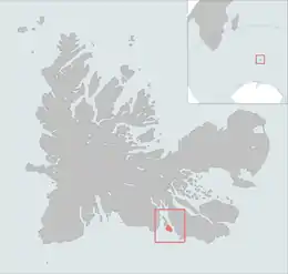
 The Île Gaby is highlighted on this Kerguelen Islands map. | |
| Geography | |
|---|---|
| Location | Indian Ocean |
| Coordinates | 49°39′S 69°46′E / 49.650°S 69.767°E |
| Archipelago | Îles Kerguelen |
| Highest elevation | 677 m (2221 ft) |
| Highest point | unnamed mountain |
| Administration | |
| District | Îles Kerguelen |
| Demographics | |
| Population | 0 |
Île Gaby is one of the Kerguelen Islands near the coast of Grande Terre, the principal island.
It lies in the Swains Bay between the south-eastern part of the Gallieni Peninsula and the west coast of the Joan of Arc Peninsula, around 1 km SE of the Altazin Island.
The highest point of the island is an unnamed mountain that reaches the elevation of 677 m above the sea level.
References
- Kerguelen islands map, Géoportail IGN.
- General view of non-metropolitan France, Maison de la Géographie.
This article is issued from Wikipedia. The text is licensed under Creative Commons - Attribution - Sharealike. Additional terms may apply for the media files.