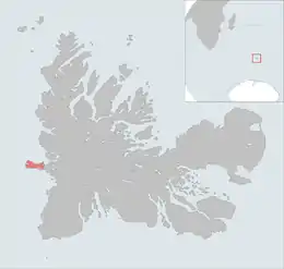
 The île de l'Ouest is highlighted on this Kerguelen Islands map. | |
| Geography | |
|---|---|
| Location | Indian Ocean |
| Coordinates | 49°21′S 68°44′E / 49.350°S 68.733°E |
| Archipelago | Îles Kerguelen |
| Total islands | 1 |
| Major islands | Île de l'Ouest |
| Area | 33.0 km2 (12.7 sq mi) |
| Area rank | 6th(In the Kerguelen Islands) |
| Length | 5 km (3.1 mi) |
| Width | 12 km (7.5 mi) |
| Coastline | 30 km (19 mi) |
| Highest elevation | 617 m (2024 ft) |
| Highest point | Pic Philippe d'Orléans |
| Administration | |
| District | Îles Kerguelen |
| Demographics | |
| Demonym | Oueste |
| Population | 0 |
The Île de l'Ouest is a French island in the Kerguelen archipelago located west of Grande Terre in the extension of the Lakes peninsula, by the foothills of the Cook glacier. It has two bays:Noroît Bay to the north and Bretonne Bay to the south.
It is divided by the Grande Terre by the détroit de la Marianne (Marianne's strait). The highest point is a mountain named Pic Philippe d'Orléans, at 617 metres.
References
- Kerguelen islands map, Géoportail IGN.
- General view of non-metropolitan France, Maison de la Géographie.
This article is issued from Wikipedia. The text is licensed under Creative Commons - Attribution - Sharealike. Additional terms may apply for the media files.