ʻAuʻasi | |
|---|---|
Village | |
 ʻAuʻasi | |
| Coordinates: 14°16′36″S 170°34′28″W / 14.27667°S 170.57444°W | |
| Country | |
| Territory | |
| Area | |
| • Total | 0.26 sq mi (0.67 km2) |
| Population (2010) | |
| • Total | 113 |
| • Density | 440/sq mi (170/km2) |
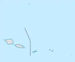
ʻAuʻasi is a village in the east of Tutuila Island, American Samoa. One of the island's more populous villages, it is located on the south coast, close to the eastern tip of the island and to the smaller offshore island of Aunuʻu. It is located in Saʻole County.
Above the village is a waterfall known as ʻAuʻasi Falls. This can be visited by following the stream in ʻAuʻasi for about 30 minutes. It is particularly impressive after heavy rain.[1]
Ferries for Aunu'u Island leave from the dock at ʻAuʻasi.
Demographics
| Population growth[2] | |
|---|---|
| 2010 | 113 |
| 2000 | 125 |
| 1990 | 122 |
| 1980 | 117 |
| 1970 | 74 |
| 1960 | 43 |
References
- ↑ Swaney, Deanna (1994). Samoa: Western & American Samoa: a Lonely Planet Travel Survival Kit. Lonely Planet Publications. Page 178. ISBN 9780864422255.
- ↑ "American Samoa Statistical Yearbook 2016" (PDF). American Samoa Department of Commerce. Archived from the original (PDF) on 2019-02-14. Retrieved 2019-07-25.
This article is issued from Wikipedia. The text is licensed under Creative Commons - Attribution - Sharealike. Additional terms may apply for the media files.