| UTC time | 2020-05-15 11:03:27 |
|---|---|
| ISC event | 618259420 |
| USGS-ANSS | ComCat |
| Local date | May 15, 2020 |
| Local time | 4:03 a.m. PT |
| Magnitude | 6.5 Mw |
| Depth | 2.7 km (1.7 mi) |
| Epicenter | 38°10′08″N 117°51′00″W / 38.169°N 117.850°W |
| Fault | Walker Lane Seismic Zone |
| Type | Strike-slip |
| Areas affected | Nevada |
| Max. intensity | VIII (Severe)[1] |
| Aftershocks | 23,314+ (As of September 22, 2021)[2] |
| Casualties | 0 |
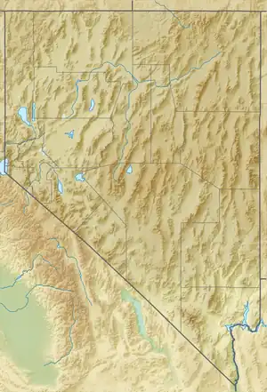
On May 15, 2020 at 4:03:27 local time, a magnitude 6.5 earthquake struck ~35 miles (56 km) west of Tonopah, Nevada in the Monte Cristo Range near the California-Nevada border.[3] It was Nevada's largest earthquake in 66 years.[4][5]
Geology
Southwestern Nevada lies within a complex zone of distributed faulting known as the Walker Lane, which carries up to a quarter of the motion of the North American Plate relative to the Pacific Plate.[3] It extends from the Garlock Fault in the southeast along the northeastern flank of the Sierra Nevada, running parallel to the California–Nevada boundary. The central Walker Lane is characterized by a zone of west–east trending left-lateral strike-slip faults that link northwest–southeast trending dominantly right-lateral strike-slip faults.[6]
Earthquake
The earthquake had a magnitude of 6.5 ML and a hypocentral depth of only 2.8 km (1.7 mi). Shaking was felt throughout California and Nevada, with some reports from as far as San Francisco, Los Angeles, and Salt Lake City.[7][8] The estimated maximum intensity of shaking was rated as VIII (Severe) on the Modified Mercalli intensity scale. The magnitude was initially reported as M 6.4, but was upgraded about 1 hour later by USGS to its current figure.[9] More than 22,300 people reported feeling the earthquake.[3]
The focal mechanism of the earthquake suggests either left-lateral strike-slip faulting on a west–east trending fault or right-lateral faulting on a north–south trending fault.[10] The distribution of aftershocks supports the first of these options.[11] The earthquake lies close to the projected eastward continuation of the Candelaria fault, which is known to have been active during the Quaternary period.[12] It also lies close to the northern end of the north–south trending Eastern Columbus Salt Marsh fault.[13]
Aftershocks
Within the first 5 hours proceeding the main shock, there were 6 aftershocks measuring magnitude 4.5 or higher, the highest being a 5.1.[14]
On November 13, at 1:13 a.m. local time, a magnitude 5.3 aftershock took place. It is the largest aftershock of the sequence.[15]
Impacts
Since the earthquake occurred in a remote and relatively uninhabited area, few people were exposed to severe shaking, hence no casualties occurred.[8][16][17] The earthquake cracked U.S. Route 95 between Reno and Las Vegas, causing it to be temporarily closed. The highway was reopened 10 hours after repair operations. Several post-earthquake field reconnaissance teams documented surface fault expressions, rock falls, subsidence features, and other geologic and geotechnical effects in the Columbus Salt Marsh to the west of U.S. Route 95 and surrounding areas. [18][19] In Tonopah, displaced items, broken windows, cracked asphalt, masonry, and drywall were reported.[20][21][22]
See also
References
- ↑ "USGS Impact summary".
- ↑ "2020 Nevada Earthquake Aftershocks USGS".
- 1 2 3 "USGS M 6.5 - Monte Cristo Range Earthquake". earthquake.usgs.gov. Retrieved May 17, 2020.
- ↑ "Largest earthquakes in Nevada since 1900, M6+". earthquake.usgs.gov. Retrieved May 17, 2020.
- ↑ Jay Croft; Carma Hassan (May 15, 2020). "Earthquake is largest in Nevada in past 66 years". CNN. Retrieved May 17, 2020.
- ↑ Wesnousky, S.G. (2005). "Active faulting in the Walker Lane". Tectonics. 24 (3). Bibcode:2005Tecto..24.3009W. CiteSeerX 10.1.1.463.7174. doi:10.1029/2004TC001645.
- ↑ ""Did you feel it?" Reports". earthquake.usgs.gov. Retrieved May 17, 2020.
- 1 2 RITTER, KEN. "Nevada highway damaged by largest area quake in 65 years". FOX5 Las Vegas. Archived from the original on May 29, 2020. Retrieved May 17, 2020.
- ↑ Puleo, Mark (May 15, 2020). "6.5 magnitude earthquake strikes Nevada, shaking felt hundreds of miles away". AccuWeather.
- ↑ "USGS Technical Summary". earthquake.usgs.gov. Retrieved May 17, 2020.
- ↑ "USGS Aftershock Distribution M2.5+". earthquake.usgs.gov. Retrieved June 8, 2020.
- ↑ Nevada Bureau of Mines and Geology. "Monte Cristo Range Earthquake - May 15, 2020, 4:03 am PDT". University of Nevada, Reno. Retrieved May 19, 2020.
- ↑ "Quaternary Fault and Fold Database of the United States". earthquake.usgs.gov. Retrieved May 17, 2020.
- ↑ "USGS Aftershocks above 4.5 M". earthquake.usgs.gov. Retrieved May 17, 2020.
- ↑ "USGS M 5.3 aftershock". earthquake.usgs.gov. Retrieved November 14, 2020.
- ↑ "USGS Ground Failure & Population Exposure summary". earthquake.usgs.gov. Retrieved May 17, 2020.
- ↑ Gross, Sam. "Nevada 'dodged a bullet' when 6.5 earthquake struck in a remote area, seismologist says". USA TODAY. Retrieved May 17, 2020.
- ↑ "Monte Cristo Range Earthquake". nevada-earthquake-clearinghouse-nbmg.hub.arcgis.com. Retrieved December 1, 2021.
- ↑ "2020 Nevada Earthquake". www.geerassociation.org. Retrieved December 1, 2021.
- ↑ RITTER, KEN (May 15, 2020). "Nevada highway damaged by area's largest quake in 65 years". Press Herald. Retrieved May 17, 2020.
- ↑ "Nevada highway damaged by largest area quake in 65 years". ABC News. Retrieved May 17, 2020.
- ↑ Tonopah residents react to 6.5-magnitude earthquake strikes Central Nevada. Retrieved May 17, 2020.
