Alega | |
|---|---|
Village | |
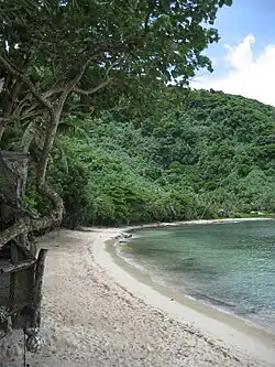
 Alega Beach | |
 Alega | |
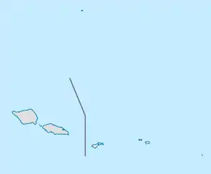
| Coordinates: 14°17′7″S 170°38′15″W / 14.28528°S 170.63750°W | |
| Country | |
| Territory | |
| County | Sua |
| Area | |
| • Total | 0.31 sq mi (0.79 km2) |
| Elevation | 26 ft (8 m) |
| Population (2010) | |
| • Total | 54 |
| • Density | 180/sq mi (68/km2) |
Alega (Samoan: Ālega) is a village on the southeast coast of Tutuila Island, American Samoa. One of the island's least populous villages, it is located to the east of Pago Pago Harbor and to the west of Faga'itua Bay.
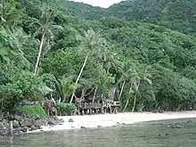
Alega lies between Lauli'i and Avaio villages, and is home to Alega Village Marine Protected Area. Tisa's Barefoot Bar is also in Alega, which is a bar that also operates a fale sleeping four on Alega Beach. The beach has a secluded character and is removed from the village. Bus services are frequent between Alega and Fagatogo.[1][2] Tisa's Barefoot Bar, which is located on Alega Beach, is perhaps the most popular bar on Tutuila Island. Tisa's Barefoot Bar offers ecotour activities such as food tastings, umu displays, cultural demonstrations, visits to the caves, hikes to Alega Waterfall and recreational water activities such as snorkeling, kayaking, and swimming. Tours are also offered to sites in the National Park area as well as transportation to 'Au'asi where ferries are offered to Aunu'u Island.[3]
Another scenic beach, Two Dollar Beach, is located next to Alega Beach.[4]
On the coast near Avaio lies the islet Faalogologotala Rock (Lions Head), where there is a small beach.[5][6]
Geography

Alega is a small valley and embayment, situated along the south coast of Tutuila Island, in-between Pago Pago Bay in the west and Fagaitua Bay in the east. Only a few houses are located in Alega, all related to the Fa’amuli family. There are also foundation remains of houses occupied in the previous century. Alega's shoreline has a thin sandy beach, first and foremost on the east side. There is a developed reef in the Alega Bay with a channel which has a powerful current. The village is bounded by steep ridge slopes, and geologically, Alega sits in the midst of the Pago Volcanics, which were formed over a million years ago. The surrounding ridges are steep, falling between 30 and 40 degrees. Most of the Alega Valley was cleared and planted at one point, however, little cultivation remains, mostly coconuts and bananas. Most of the surrounding area is covered with trees and scrub.[7]
Alega Beach has been named one of the best beaches in American Samoa by Lonely Planet. The fale at Tisa's Barefoot Bar has also been named “one of the best places to stay in American Samoa” by Lonely Planet.
Demographics
| Population growth[8] | |
|---|---|
| 2010 | 54 |
| 2000 | 54 |
| 1990 | 49 |
| 1980 | 30 |
References
- ↑ Stanley, David (2004). South Pacific. Moon Handbooks. Page 483. ISBN 9781566914116.
- ↑ "Alega Beach | American Samoa Activities".
- ↑ International Business Publications IBP, Inc. (2007). Samoa (American): Doing Business, Investing in Samoa (American) Guide - Strategic Information, Regulations, Contacts. Lulu Press, Inc. Page 132. ISBN 9781433011863.
- ↑ Schyma, Rosemarie (2013). Südsee. DuMont Reiseverlag. Page 268. ISBN 9783770176946.
- ↑ "Things to See in American Samoa | Frommer's".
- ↑ Goodwin, Bill (2006). Frommer’s South Pacific. Wiley. Page 401. ISBN 9780471769804.
- ↑ http://ashpo.com/downloads/library/7500023.pdf (Page 2)
- ↑ "American Samoa Statistical Yearbook 2016" (PDF). American Samoa Department of Commerce. Archived from the original (PDF) on 2019-02-14. Retrieved 2019-07-25.