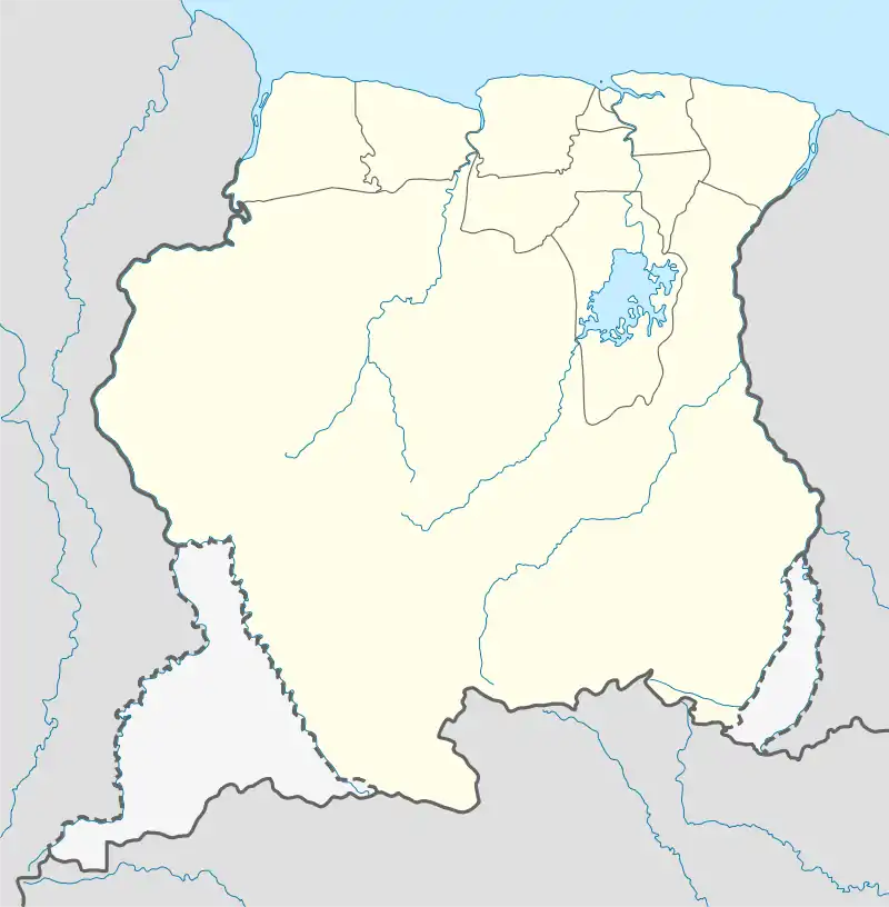
Amatopo
Amotopo | |
|---|---|
 Amatopo Location in Suriname | |
| Coordinates: 3°32′50″N 57°38′35″W / 3.54722°N 57.64306°W | |
| Country | Suriname |
| District | Sipaliwini District |
| Resort | Coeroeni |
| Government | |
| • Head captain | Pepoe Ipajari[1] |
| Population (2020) | |
| • Total | 27[1] |
Amatopo or Amotopo is a Tiriyó village on the Courentyne River in the Sipaliwini District of Suriname.[2] The village lies next to the Amatopo Airstrip and about 7 kilometres (4.3 mi) upstream from the village of Lucie. The Frederik Willem IV Falls and Arapahu Island are located near the village.
Overview
The residents of the village consider themselves Okomoyana, which means "wasp people". The Okomoyana category can be seen as a subdivision of the Tiriyó people, and the Okomoyana indeed speak the Tiriyó language.[3] The villagers who settled in the village came from Kwamalasamutu.[4]
The airstrip was constructed during Operation Grasshopper. In the West Suriname Plan, Amatopo was to play an important role in the mining of bauxite in the area. Even a road was constructed from Amatopo to Paramaribo, but this road was deserted after the Surinamese Interior War.[5] The first two settlers moved into the unused buildings near the airstrip. Later a pilot chased them away. Asongo Alalaparu, the granman (paramount chief) told them to return, and built their houses next to the facilities which were already present. The settlement started in 2001.[6]
Frederik Willem IV Falls
The Frederik Willem IV Falls also Anora Falls[7] are located in the Courentyne River near Amatopo. In 1871, Charles Barrington Brown discovered that the river above the waterfalls splits into two rivers. Arapahu Island is a river island located below the waterfalls.[8]
Tourism
An eco-lodge at Arapahu Island is situated half an hour upstream from Amatopo. The visitors of the eco-lodge make use of Amatopo Airstrip to reach their destination.[5]
Notes
- 1 2 "Dorpen en Dorpsbesturen". Vereniging van Inheemse Dorpshoofden in Suriname (in Dutch). Retrieved 22 June 2022.
- ↑ Carlin & Mans 2015, p. 93.
- ↑ Mans 2011, p. 208.
- ↑ Heemskerk & Delvoye 2007, p. 129.
- 1 2 Mans 2011, p. 209.
- ↑ Mans 2012, p. 131.
- ↑ "Distrikt Sipaliwini 2". Suriname.nu (in Dutch). Retrieved 16 December 2021.
- ↑ Patrick Woodhead (21 May 2006). "Tumble in the Jungle". New York Times. Retrieved 16 December 2021.
References
- Carlin, Eithne B.; Mans, Jimmy (2015). "Movement through Time in the Southern Guianas: Deconstructing the Amerindian Kaleidoscope". In Carlin, Eithne B.; Léglise, Isabelle; Migge, Bettina; Tjon Sie Fat, Paul B. (eds.). In and Out of Suriname: Language, Mobility and Identity. Leiden, Boston: Brill. pp. 76–100. ISBN 978-90-04-28011-3.
- Heemskerk, Marieke; Delvoye, Katia (2007). Trio Baseline Study: A sustainable livelihoods perspective on the Trio Indigenous Peoples of South Suriname (PDF). Paramaribo: Stichting Amazon Conservation Team-Suriname.
- Mans, Jimmy (2011). "Trio movements and the Amotopoan flux". In Hofman, Corinne Lisette; Van Duijvenbode, Anne (eds.). Communities in contact: Essays in archaeology, ethnohistory and ethnography of the Amerindian circum-Caribbean. Leiden: Sidestone Press. pp. 205–222. ISBN 978-90-88-90063-1.
- Mans, Jimmy (2012). Amotopoan trails: a recent archaeology of Trio movements. Leiden: Sidestone Press. hdl:1887/19857. ISBN 978-90-8890-098-3.