Phlapphla Chai
พลับพลาชัย | |
|---|---|
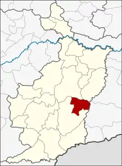 District location in Buriram province | |
| Coordinates: 14°43′48″N 103°10′6″E / 14.73000°N 103.16833°E | |
| Country | Thailand |
| Province | Buriram |
| Seat | Sadao |
| Area | |
| • Total | 320.1 km2 (123.6 sq mi) |
| Population (2005) | |
| • Total | 42,773 |
| • Density | 122.3/km2 (317/sq mi) |
| Time zone | UTC+7 (ICT) |
| Postal code | 31250 |
| Geocode | 3115 |
Phlapphla Chai (Thai: พลับพลาชัย, pronounced [pʰláp.pʰlāː t͡ɕʰāj]) is a district (amphoe) of Buriram province, northeastern Thailand.
Geography
Neighbouring districts are (from the south clockwise) Prakhon Chai, Mueang Buriram, Krasang of Buriram Province and Prasat of Surin province.
History
The minor district (king amphoe) was created on 1 April 1989, when five tambons were split off from Prakhon Chai district.[1] It was upgraded to a full district on 4 July 1994.[2]
Administration
The district is divided into five sub-districts (tambons), which are further subdivided into 67 villages (mubans). Phlapphla Chai is a township (thesaban tambon) which covers parts of tambon Sadao. There are also five tambon administrative organizations (TAO).
| No. | Name | Thai name | Villages | Pop. | |
|---|---|---|---|---|---|
| 1. | Chan Dum | จันดุม | 18 | 10,421 | |
| 2. | Khok Khamin | โคกขมิ้น | 15 | 9,266 | |
| 3. | Pa Chan | ป่าชัน | 10 | 5,852 | |
| 4. | Sadao | สะเดา | 13 | 9,158 | |
| 5. | Samrong | สำโรง | 11 | 8,076 |
References
- ↑ ประกาศกระทรวงมหาดไทย เรื่อง แบ่งท้องที่อำเภอประโคนชัย จังหวัดบุรีรัมย์ ตั้งเป็นกิ่งอำเภอพลับพลาชัย (PDF). Royal Gazette (in Thai). 106 (40 ง): 1887. March 14, 1989. Archived from the original (PDF) on April 6, 2012.
- ↑ พระราชกฤษฎีกาตั้งอำเภอเปือยน้อย ... และอำเภอศรีวิไล พ.ศ. ๒๕๓๗ (PDF). Royal Gazette (in Thai). 111 (21 ก): 32–35. June 3, 1994. Archived from the original (PDF) on September 30, 2007.
External links
This article is issued from Wikipedia. The text is licensed under Creative Commons - Attribution - Sharealike. Additional terms may apply for the media files.