| Angrapa Węgorapa | |
|---|---|
 The Angrapa River in Mieduniszki Wielkie, Poland | |
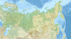
 Location of mouth in Russia | |
| Location | |
| Country | Poland, Russia |
| Physical characteristics | |
| Source | |
| • location | Lake Mamry |
| • coordinates | 54°11′51″N 21°43′07″E / 54.19750°N 21.71861°E |
| Mouth | |
• location | Pregolya |
• coordinates | 54°38′52″N 21°47′29″E / 54.6479°N 21.7913°E |
| Basin features | |
| Progression | Pregolya→ Baltic Sea |
The Angrapa (Russian: Анграпа, Polish: Węgorapa, German: Angerapp, Lithuanian: Angrapė) is a river that begins in northeastern Poland and ends in the Kaliningrad Oblast of Russia. Originating in Lake Mamry, it joins the 101-km-long Instruch at a point near Chernyakhovsk – variously assessed as lying 140,[1] 169,[2] or 172 km[3] from its source – to form the Pregolya. Its largest tributaries are the 89-km-long Gołdapa, which joins just before the border, and the Pissa (98 km).
The name Angrapa is derived from the Old Prussian words anguris (eel) and apis (river). The towns of Węgorzewo, Ozyorsk and Chernyakhovsk as well as the village of Mayakovskoye, are situated along the course of the Angrapa.
References
- ↑ Second Assessment of transboundary rivers, lakes and groundwaters by the Economic Commission for Europe
- ↑ Angrapa in the State Water Register of Russia
- ↑ "Hydrologia Pojezierza Mazurskiego". Archived from the original on 2020-10-30. Retrieved 2017-10-02.
See also
This article is issued from Wikipedia. The text is licensed under Creative Commons - Attribution - Sharealike. Additional terms may apply for the media files.