| Antapite | |
|---|---|
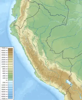 Antapite Peru | |
| Highest point | |
| Elevation | 4,410 m (14,470 ft) |
| Coordinates | 13°31′05″S 74°32′57″W / 13.51806°S 74.54917°W |
| Geography | |
| Location | Ayacucho, Peru |
| Parent range | Andes |
Antapite[1][2] (possibly from Quechua anta copper, p'iti dividing by pulling powerfully to the extremes; gap, interruption[3]) is a 4,410-metre-high (14,469 ft)[1] mountain in the Andes of Peru. It is located in Ayacucho Region, Cangallo Province, on the border of the districts of Paras and Totos. Antapite lies north of mount Ccerone.[1] Mines in the Antapite region carry precious and base metals which contribute to the local and global economy.[4]
References
- 1 2 3 Peru 1:100 000, Paras (28-n). IGN (Instituto Geográfico Nacional - Perú).
- ↑ "UGEL Cangallo" (PDF). ESCALE - Mapas DRE y UGEL. Unidad de Estadística Educativa - Ministerio de Educación (Perú). 2010. Archived from the original (PDF) on 2016-08-16. Retrieved 2016-06-18.
- ↑ Teofilo Laime Ajacopa (2007). Diccionario Bilingüe: Iskay simipi yuyayk’anch: Quechua – Castellano / Castellano – Quechua (PDF). La Paz, Bolivia: futatraw.ourproject.org.
- ↑ Lechuga, José Cabello (January 2000). "Thirty years of Base and Precious Metals Exploration in the Central Andes". SGA News (8).
This article is issued from Wikipedia. The text is licensed under Creative Commons - Attribution - Sharealike. Additional terms may apply for the media files.