 | |
|---|---|
| Route information | |
| Length | 57.9 km (36.0 mi) |
| Major junctions | |
| From | |
| To | |
| Location | |
| Country | Croatia |
| Counties | Koprivnica-Križevci |
| Major cities | Koprivnica, Križevci |
| Highway system | |
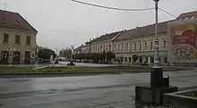
Koprivnica, on the D41 road route
D41 is a state road in the central Croatia connecting Križevci to Koprivnica and Gola border crossing to Hungary.[1][maps 1] The road is 57.9 km (36.0 mi) long.[2]
The road, as well as all other state roads in Croatia, is managed and maintained by Hrvatske ceste, a state-owned company.[3]
Traffic volume
Traffic is regularly counted and reported by Hrvatske ceste, one of the operators of the road.[4]
| D41 traffic volume | ||||
| Road | Counting site | AADT | ASDT | Notes |
| 1401 Gola | 929 | 1,066 | Between the Ž2116 and Ž2115 junctions. | |
| 1310 Peteranec | 2,291 | 2,496 | Between the Ž2114 and Ž2113 junctions. | |
| 1311 Sokolovac | 3,836 | 3,809 | Adjacent to the L26006 junction. | |
Road junctions and populated areas
| D41 junctions/populated areas | |
| Type | Slip roads/Notes |
| Gola border crossing[1] The route extends to Berzence, Hungary. The northern terminus of the road. | |
| Gola Ž2116 to Novačka and Repaš (D210). | |
| Ž2115 to Otočka. | |
| Gotalovo | |
| Drava Bridge | |
| Ž2091 to Šoderica. | |
| Botovo | |
| Drnje Ž2260 to Torčec and Đelekovec (D20). Ž2114 to Hlebine and Molve (D210). | |
| Peteranec Ž2113 to Ž2114 county road. | |
| Koprivnica | |
| Reka | |
| Velika Mučna | |
| Sokolovac Ž2181 to Srijem and Široko Selo. | |
| Ž2139 to Veliki Botinovac and Mali Grabičani. | |
| Carevdar | |
| Ž2238 to Kloštar Vojakovački. | |
| Ž2180 to Vojakovec, Čabraji and Ivanec Križevački. | |
| Majurec Ž2212 to Sveti Petar Čvrstec and Zrinski Topolovac. | |
| Križevci The southern terminus of the road. | |
Maps
- ↑ Overview map of the D41 (Map). OpenStreetMap. Retrieved July 21, 2014.
Sources
- 1 2 "Map of border crossings and customs office areas" (PDF). Customs Administration of the Republic of Croatia (in Croatian). March 6, 2008.
- ↑ Ministry of Sea, Transport and Infrastructure (Croatia) (November 15, 2018). "Decision on categorization of public roads". Narodne novine (in Croatian). Narodne novine. Retrieved February 7, 2020.
- ↑ "Public Roads Act". Narodne novine (in Croatian). December 14, 2004.
- ↑ "Brojenje prometa na cestama Republike Hrvatske godine 2015" [Traffic counting on the roadways of Croatia in 2015] (PDF) (in Croatian). Hrvatske ceste. April 2016. Archived from the original (PDF) on 2016-07-01. Retrieved 2016-06-23.
This article is issued from Wikipedia. The text is licensed under Creative Commons - Attribution - Sharealike. Additional terms may apply for the media files.