Daska
| |
|---|---|
City | |
 | |
 Daska  Daska | |
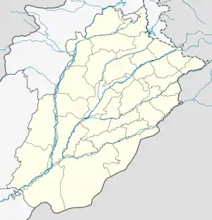
| Coordinates: 32°20′N 74°21′E / 32.333°N 74.350°E | |
| Country | Pakistan |
| Province | Punjab |
| Division | Gujranwala |
| District | Sialkot |
| Tehsil | Daska |
| Government | |
| • MNA(s) | Syeda Nosheen Iftikhar (NA-75 (Sialkot-IV)) |
| • MPA(s) | |
| Elevation | 217 m (712 ft) |
| Population | |
| • City | 175,464 |
| • Rank | 50th, Pakistan |
| Time zone | UTC+5 (PST) |
| Calling code | 052 |
| Number of towns | 1 |
| Postal Code | 51010 |
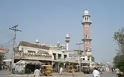
Daska (Punjabi: ڈسکا; Urdu: ڈسکہ), is a city in the Punjab province of Pakistan. The city is the capital of Daska Tehsil, one of four tehsils of Sialkot District.[2] It is the 50th largest city of Pakistan by population. It is 29th largest by population in Punjab.
History
17th-19th centuries
Daska was founded during the reign of Shah Jahan, and was initially named Shah Jahanabad, according to Mughal revenue records.[3] It was later renamed Daska as it is das ("ten") koh (Mughal unit of distance) from Sialkot, Pasrur, Gujranwala, and Wazirabad.[4] During the Afghan Durrani invasion of the 18th century, Daska was ruined, and its inhabitants were forced to seek shelter in the nearby mudfort of Kot Daska.[5] Daska was later repopulated during the Sikh era.[6] Daska was captured by Ranjit Singh in 1802 and made part of the Sikh Empire.[7]
20th century
In 1929, Daska was the site of Hindu-Sikh riots when Akali Sikhs attempted to seize control of Gurdwara Sant Wayaram Singh. The local Hindu community claimed it was built to be a dharamsala.[8]
In August 1947, 5,000 refugees from surrounding areas gathered at Daska Camp for two weeks before being escorted to the Indian border by the Pakistani Military.[9]
Economy and Geography
Daska Tehsil was once the biggest tehsil in Pakistan, containing almost 400 villages.
There are a number of agricultural machinery manufacturers based in Daska.[10] Being surrounded by big industrial cities such as Gujranwala and Sialkot, Daska has a very healthy employment rate. The urban area of Daska is no more than 3 kilometres (1.9 mi) in length but it still manages to hold the title of an industrial city which contributes a lot to the national economy. Mughal, Kashmiri, Rajput, Arain, and Malik tribes are prominent in the urban area and several Jatt tribes are in the majority in rural areas. The Bambawali-Ravi-Bedian Canal flows through its centre which makes the surrounding area fertile and rich in crops.
See also
References
- ↑ "PAKISTAN: Provinces and Major Cities". PAKISTAN: Provinces and Major Cities. citypopulation.de. Retrieved 4 May 2020.
- ↑ Tehsils & Unions in the District of Sialkot – Government of Pakistan Archived 9 February 2012 at the Wayback Machine
- ↑ Commissioner, Pakistan Office of the Census (1962). Population Census of Pakistan, 1961: Dacca. 2.Chittagong. 3.Sylhet. 4.Rajshahi. 5.Khulna. 6.Rangpur. 7.Mymensingh. 8.Comilla. 9.Bakerganj. 10.Noakhali. 11.Bogra. 12.Dinajpur. 13.Jessore. 14.Pabna. 15.Kushtia. 16.Faridpur. 17.Chittagong Hill tracts.
- ↑ Gazetteer of the Jhang District: 1883. 1883.
- ↑ Gazetteer of the Jhang District: 1883. 1883.
- ↑ Gazetteer of the Jhang District: 1883. 1883.
- ↑ bahādur.), Muḥammad Laṭīf (Saiyid, khān (1891). History of the Panjáb from the Remotest Antiquity to the Present Time. Calcutta Central Press Company, limited.
{{cite book}}: CS1 maint: multiple names: authors list (link) - ↑ Nijjar, Bakhshish Singh (1996). History of the United Panjab. Atlantic Publishers & Dist. ISBN 978-81-7156-534-4.
- ↑ Page, Co-Director Media South Asia Project Institute of Development Studies David; Page, David; Singh, Anita Inder; Moon, Penderel; Khosla, G. D. (2002). The Partition Omnibus. Oxford University Press. ISBN 978-0-19-565850-7.
- ↑ "Sialkot: Chinese to assist Daska machinery makers". Dawn. 14 May 2004. Retrieved 12 September 2020.