Kampong Batu Marang | |
|---|---|
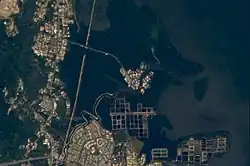
 Batu Marang as seen from space in 2010. | |
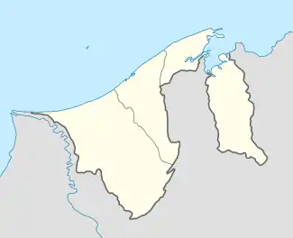
 Location in Brunei | |
| Coordinates: 4°58′55″N 115°02′01″E / 4.9819°N 115.0335°E | |
| Country | Brunei |
| District | Brunei-Muara |
| Mukim | Mentiri |
| Population (2016)[1] | |
| • Total | 870 |
| Time zone | UTC+8 (BNT) |
| Postcode | BU1529 |
Kampong Batu Marang is a village within Mukim Mentiri in Brunei-Muara District, Brunei. The population was 870 in 2016.[1]
Geography
Kampong Batu Marang is located in the northeastern part of the district. As a village subdivision, it borders Kampong Salar to the north, the Brunei Bay to the east, RPN Kampong Mentiri to the south, Kampong Mentiri to the southwest and Kampong Sungai Buloh to the west.[2] The actual populated area only exists as a small cluster of stilted dwellings on the banks near the mouth of Mentiri River, a small river which flows into the Brunei Bay, and surrounded by dense vegetation. It is only accessible by land from Kampong Sungai Buloh.
Facilities
School
- Batu Marang Primary School
Mosque
Kampong Batu Marang Mosque is the village mosque and was opened for use on 19 January 1996.[3] It can accommodate 1,000 worshippers.[3] The mosque celebrated its silver jubilee anniversary of its establishment in 2021.[4]
See also
References
- 1 2 "Population and Housing Census Update Final Report 2016" (PDF). www.deps.gov.bn. Department of Statistics. December 2018. Retrieved 4 July 2021.
- ↑ Brunei Darussalam street directory : quick & easy reference maps., Brunei Press Sdn. Bhd., 2014, pp. 33 & 44, ISBN 9789991732411, OCLC 932264901
- 1 2 "SenaraiMasjid - Masjid Kampong Batu Marang". www.kheu.gov.bn (in Malay). Retrieved 15 February 2018.
- ↑ Azlan Othman (21 January 2021). "Mosque marks silver jubilee". Borneo Bulletin. Retrieved 5 July 2021.