Bondara بندارا | |
|---|---|
Town | |
 | |
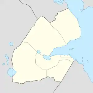
 Bondara بندارا Location in Djibouti | |
| Coordinates: 11°01′N 42°20′E / 11.017°N 42.333°E | |
| Country | |
| Region | Dikhil |
| Elevation | 470 m (1,540 ft) |
| Population (2019) | |
| • Total | 387 |
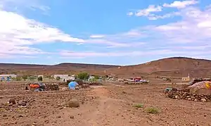
Bondara is a town in the south of Dikhil Region. It is situated about 11 kilometres (6 miles) south of Dikhil and 2 km north of the border with Ethiopia.
Overview
The town lies near the border with Ethiopia. Nearby towns and villages include Dikhil (10 km), Sankal (15 km) and As Eyla (26 km).
Demographics
The town inhabitants belong to various mainly Afro-Asiatic-speaking ethnic groups, with the Issa Somali predominant.
Climate
Bondara is located at an altitude of 470 meters above sea level in low-shrouded mountains and hills and the surrounding mountains.
| Climate data for Bondara | |||||||||||||
|---|---|---|---|---|---|---|---|---|---|---|---|---|---|
| Month | Jan | Feb | Mar | Apr | May | Jun | Jul | Aug | Sep | Oct | Nov | Dec | Year |
| Mean daily maximum °C (°F) | 27.2 (81.0) |
27.4 (81.3) |
28.0 (82.4) |
28.2 (82.8) |
31.1 (88.0) |
35.4 (95.7) |
38.5 (101.3) |
37.5 (99.5) |
33.7 (92.7) |
29.4 (84.9) |
28.2 (82.8) |
27.5 (81.5) |
31.0 (87.8) |
| Mean daily minimum °C (°F) | 17.5 (63.5) |
18.8 (65.8) |
20.0 (68.0) |
21.6 (70.9) |
23.3 (73.9) |
25.5 (77.9) |
27.9 (82.2) |
27.4 (81.3) |
25.2 (77.4) |
22.2 (72.0) |
19.4 (66.9) |
17.8 (64.0) |
22.2 (72.0) |
| Average precipitation mm (inches) | 7 (0.3) |
8 (0.3) |
11 (0.4) |
25 (1.0) |
9 (0.4) |
2 (0.1) |
30 (1.2) |
43 (1.7) |
39 (1.5) |
8 (0.3) |
6 (0.2) |
2 (0.1) |
190 (7.5) |
| Source: Climate-Data.org | |||||||||||||
References
This article is issued from Wikipedia. The text is licensed under Creative Commons - Attribution - Sharealike. Additional terms may apply for the media files.