| Cascade River | |
|---|---|
Route of the Cascade River | |
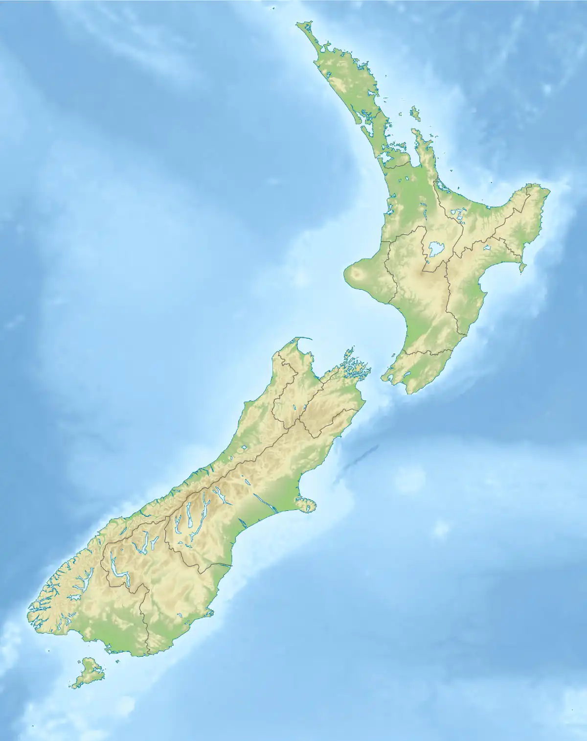 Mouth of the Cascade River  Cascade River (New Zealand) (South Island) | |
| Native name | Tahutahi (Māori) |
| Location | |
| Country | New Zealand |
| region | West Coast Region |
| District | Westland District |
| Physical characteristics | |
| Source | Toreador Peak |
| • location | Olivine Range |
| • coordinates | 44°21′47″S 168°23′40″E / 44.36306°S 168.39444°E |
| • elevation | 1,400 m (4,600 ft) |
| Mouth | Tasman Sea |
• location | 44°1′48″S, 168°21′52″E |
• coordinates | 44°1′48″S 168°21′52″E / 44.03000°S 168.36444°E |
• elevation | 0 m (0 ft) |
| Length | 67 kilometres (42 mi) |
| Basin features | |
| Progression | Limbo Glacier → Limbo Stream → Cascade River → Tasman Sea |
| River system | Cascade River |
| Tributaries | |
| • left | Barn River |
| • right | Martyr River |
The Cascade River (Māori: Tahutahi) is a river of the South Island of New Zealand. It flows north for 30 kilometres (19 mi) from its source in Mount Aspiring National Park in the Southern Alps, forming a deep valley between the Olivine Range and Red Hills Range. From the end of this valley it turns west to cross a low-lying swampy floodplain before entering the Tasman Sea close to Cascade Point, a headland halfway between Big Bay and Jackson Bay.
See also
References
- Land Information New Zealand - Search for Place Names
This article is issued from Wikipedia. The text is licensed under Creative Commons - Attribution - Sharealike. Additional terms may apply for the media files.