| Chimney Rock | |
|---|---|
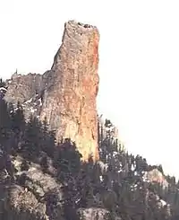 Chimney Rock from the northwest | |
| Highest point | |
| Elevation | 1,725 m (5,659 ft)[1] |
| Prominence | 45 m (148 ft)[1] |
| Listing | Mountains of British Columbia |
| Coordinates | 50°52′42″N 121°43′14″W / 50.87833°N 121.72056°W[1] |
| Geography | |
| Location | British Columbia, Canada |
| Parent range | Marble Range |
| Topo map | NTS 92I13 Pavilion[1] |
| Climbing | |
| First ascent | 1957 Hank Mather; Elfida Pigou[1] |
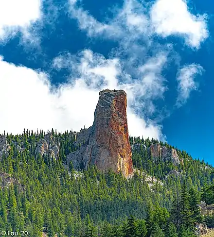
Chimney Rock Statimc, is a limestone formation in Marble Canyon, midway between the towns of Lillooet and Cache Creek in British Columbia, Canada. It is located within Marble Canyon Provincial Park.
Chimney Rock
References
External links
- "Chimney Rock". Bivouac.com.
This article is issued from Wikipedia. The text is licensed under Creative Commons - Attribution - Sharealike. Additional terms may apply for the media files.