| Combaning New South Wales | |
|---|---|
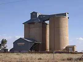 Silos at Combaning | |
 Combaning | |
| Coordinates | 34°27′31″S 147°40′56″E / 34.45861°S 147.68222°E |
| Population | 100 (2021 census)[1] |
| Postcode(s) | 2666 |
| Elevation | 303 m (994 ft) |
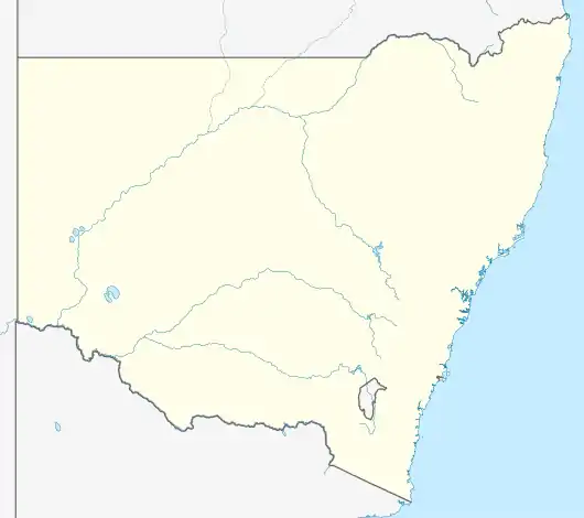
| Location |
|
| LGA(s) | Temora Shire |
| County | Bland |
| State electorate(s) | Cootamundra |
| Federal division(s) | Riverina |
Combaning is a rural community in the north east part of the Riverina. It is situated by road, about 3 kilometres west of Springdale and 13 kilometres east of Temora. At the 2021 census, Combaning had a population of 100 people.[1]
The place name Combaning is derived from the local Aboriginal (Yuin) word meaning 'to hold water'.[3]
Combaning railway station
A railway station on the branch line to Lake Cargelligo served the community between 1893 and 1975.[4]
| Preceding station | Former Services | Following station | ||
|---|---|---|---|---|
| Temora towards Lake Cargelligo |
Lake Cargelligo Line | Springdale towards Cootamundra | ||
Notes and references
- 1 2 Australian Bureau of Statistics (28 June 2022). "Combaning". 2021 Census QuickStats. Retrieved 28 September 2023.
- ↑ Travelmate Archived 24 March 2007 at the Wayback Machine
- ↑ "Combaning". Geographical Names Register (GNR) of NSW. Geographical Names Board of New South Wales.
- ↑ Combaning station. NSWrail.net, retrieved 6 September 2009.
Wikimedia Commons has media related to Combaning, New South Wales.
This article is issued from Wikipedia. The text is licensed under Creative Commons - Attribution - Sharealike. Additional terms may apply for the media files.