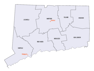
| Counties of Connecticut | |
|---|---|
 | |
| Location | State of Connecticut |
| Number | 8 |
| Populations | 116,418 (Windham) – 957,419 (Fairfield) |
| Areas | 369 square miles (960 km2) (Middlesex) – 920 square miles (2,400 km2) (Litchfield) |
| Government |
|
| Subdivisions |
|

There are eight counties in the U.S. state of Connecticut.
Four of the counties – Fairfield, Hartford, New Haven and New London – were created in 1666, shortly after the Connecticut Colony and the New Haven Colony combined. Windham and Litchfield Counties were created later in the colonial era, while Middlesex and Tolland Counties were created after American independence (both in 1785). Six of the counties are named for locations in England, where many early Connecticut settlers originated; Fairfield County was named after the salt marshes that bordered the coast, while New Haven County was named for the New Haven Colony.[1]
Although Connecticut is divided into counties, there are no county-level governments, and local government in Connecticut exists solely on the municipality level.[2] Almost all functions of county government were abolished in Connecticut in 1960,[3] except for elected county sheriffs and their departments under them. Those offices and their departments were abolished by an act of the state legislature effective in December 2000. The functions the county sheriffs' departments played were assumed by the newly organized State Marshal Commission and the Connecticut Department of Corrections.[4]
These counties are used in legacy geography, such as identifying land, national statistics and firmly within personnel rostering and court jurisdictions in the state's judicial and state marshal system. However, the three most populous—Fairfield, Hartford and New Haven—are as to many types of jurisdiction subdivided.[5]
In 2019 the state recommended to the United States Census Bureau that the nine Councils of Governments replace its counties for statistical purposes. According to the Census Bureau, "Connecticut's COGs/Planning Regions have the authority to carry out administrative functions that are typically found among counties in other states."[6] This proposal was approved by the Census Bureau in 2022, and will be fully implemented by 2024.[7]
.png.webp)
U.S. Census Bureau

The United States Census Bureau formally recognized the planning regions/councils of government as county equivalents in the Federal Register on June 6, 2022. A draft notice of potential recognition would have adapted the existing FIPS codes for the eight "legacy counties", however in response to submitted comments, the bureau retired the codes and assigned new ones to more clearly illustrate the break in geographic continuity. The Census noted that there is substantial correlation between the historic county borders and planning regions, however planning regions may incorporate towns from several counties. The bureau notes that the recognition of planning regions as county equivalents was unique to the specific conditions in Connecticut, and would not constitute a binding precedent on similar conditions in other states.[9]
Alphabetical listing
| County |
FIPS code[10] | Seat[lower-alpha 2][12] | Est.[12] | Origin[1] | Etymology[13] | Population[14] | Area[12] | Map |
|---|---|---|---|---|---|---|---|---|
| Fairfield County | 001 | Bridgeport | 1666 | original county | From the hundreds of acres of salt marsh that bordered the coast. | 959,768 | 626 sq mi (1,621 km2) |  |
| Hartford County | 003 | Hartford | 1666 | original county | After Hertford, England (still said Hartford) | 896,854 | 736 sq mi (1,906 km2) |  |
| Litchfield County | 005 | Litchfield | 1751 | From parts of Fairfield, Hartford and New Haven Counties | City of Lichfield, Staffordshire, England | 185,000 | 920 sq mi (2,383 km2) |  |
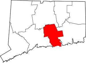
| Middlesex County | 007 | Middletown | 1785 | From parts of Hartford and New London Counties | Former county of Middlesex, England | 164,759 | 369 sq mi (956 km2) |  |
| New Haven County | 009 | New Haven | 1666 | original county | After New Haven Colony, founded as a haven in which Puritans could be free from persecution. | 863,700 | 606 sq mi (1,570 km2) |  |
| New London County | 011 | New London | 1666 | original county | After London, England | 268,805 | 666 sq mi (1,725 km2) |  |
| Tolland County | 013 | Rockville | 1785 | From parts of Hartford and Windham Counties | Hamlet of Tolland, Somerset, England | 150,293 | 410 sq mi (1,062 km2) |  |
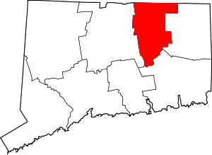
| Windham County | 015 | Willimantic | 1726 | From parts of Hartford and New London Counties | Either after Windham (now Wineham) in Sussex or Windham (now Wymondham, still said Windham) in Norfolk, England | 116,418 | 513 sq mi (1,329 km2) |  |
Former counties
Both were extraterritorial:
- Trumbull County, the Connecticut Western Reserve, ceded to Ohio in 1800
- Westmoreland County, Connecticut around Wilkes-Barre, ceded to Pennsylvania in 1784
Notes
- ↑ All land in Connecticut is covered by an incorporated city or town. County borders match constituent city and town borders. See Local government in Connecticut
- ↑ Officially, Connecticut has no county seats.[11] The listed communities are instead historical county seats.
References
- 1 2 Clark, George Larkin (1914). A History of Connecticut: Its People and Institutions. G. P. Putnam's Sons. p. 1.
a history of Connecticut.
- ↑ An Overview of County Government Archived July 8, 2008, at the Wayback Machine, National Association of Counties website, accessed January 5, 2008
- ↑ https://www.cga.ct.gov/PS98/rpt%5Colr%5Chtm/98-R-0086.htm#:~:text=Because%20the%20state%20and%20local,a%20viable%20source%20of%20government. "Because the state and local governments had historically wielded substantial authority within Connecticut, county governments never achieved the authority needed to gain a stronghold as a viable source of government."
- ↑ "State Marshals Directory - CT Judicial Branch".
- ↑ "Connecticut Judicial District Map". jud.ct.gov. Retrieved February 24, 2021.
- ↑ "Proposed Change to County Equivalents in Connecticut" (PDF). US Census Bureau.
- ↑ https://portal.ct.gov/Office-of-the-Governor/News/Press-Releases/2022/06-2022/Governor-Lamont-Announces-Census-Bureau-Approves-Proposal-for-Planning-Regions Governor Lamont Announces U.S. Census Bureau Approves Proposal for Connecticut's Planning Regions To Become County Equivalents
- ↑ "Change to County-Equivalents in the State of Connecticut". Federal Register. June 6, 2022. Retrieved March 24, 2023.
- ↑ "Change to County-Equivalents in the State of Connecticut". Federal Register. June 6, 2022. Retrieved March 24, 2023.
- ↑ "EPA County FIPS Code Listing". EPA.gov. Archived from the original on October 7, 2012. Retrieved February 23, 2008.
- ↑ "Connecticut State Register and Manual, Section VI: Counties". Connecticut Official State Website (Office of Secretary of State).
- 1 2 3 National Association of Counties. "NACo – Find a county". Archived from the original on September 27, 2007. Retrieved April 30, 2008.
- ↑ Beatty, Michael (2001). County Name Origins of the United States. McFarland Press. ISBN 0-7864-1025-6.
- ↑ "Connecticut QuickFacts". U.S. Census Bureau. Retrieved March 31, 2022.