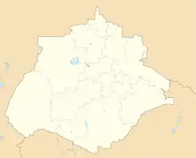
Cosío | |
|---|---|
 Coat of arms | |
Interactive map | |
 | |
 Cosío Location in Mexico  Cosío Cosío (Mexico) | |
| Coordinates: 22°22′N 102°18′W / 22.367°N 102.300°W | |
| Country | Mexico |
| State | Aguascalientes |
| Municipal seat | Cosío |
| Area | |
| • Total | 129.21 km2 (49.89 sq mi) |
| Population (2015) | |
| • Total | 15,577 |
| • Density | 120/km2 (310/sq mi) |
Cosio is a municipality and town in the Mexican state of Aguascalientes. It stands at 22°22′N 102°18′W / 22.367°N 102.300°W. The municipal seat is the town of Cosío. As of 2010, the town of Cosío had a population of 4,898.[1]
Demographics
| Year | Pop. | ±% |
|---|---|---|
| 2010 | 15,042 | — |
| 2015 | 15,577 | +3.6% |
| 2020 | 17,000 | +9.1% |
| [2][3][4][5] | ||
As of 2010, the municipality had a total population of 15,042.[1]
As of 2010, the town of Cosío had a population of 4,898.[1] Other than the town of Cosío, the municipality had 85 localities, the largest of which (with 2010 populations in parentheses) were: La Punta (2,416), El Refugio de Providencia (Providencia) (1,377), El Salero (1,229), and Santa María de la Paz (1,026), classified as rural.[1]
Geography
Climate
| Climate data for Cosío (1951–2010) | |||||||||||||
|---|---|---|---|---|---|---|---|---|---|---|---|---|---|
| Month | Jan | Feb | Mar | Apr | May | Jun | Jul | Aug | Sep | Oct | Nov | Dec | Year |
| Record high °C (°F) | 28.0 (82.4) |
32.0 (89.6) |
32.0 (89.6) |
34.0 (93.2) |
36.0 (96.8) |
36.0 (96.8) |
34.0 (93.2) |
32.0 (89.6) |
31.5 (88.7) |
32.0 (89.6) |
31.0 (87.8) |
28.0 (82.4) |
36.0 (96.8) |
| Mean daily maximum °C (°F) | 21.0 (69.8) |
22.8 (73.0) |
25.6 (78.1) |
27.6 (81.7) |
29.4 (84.9) |
28.7 (83.7) |
26.8 (80.2) |
26.4 (79.5) |
25.8 (78.4) |
25.1 (77.2) |
23.6 (74.5) |
21.5 (70.7) |
25.4 (77.7) |
| Daily mean °C (°F) | 12.5 (54.5) |
13.9 (57.0) |
16.4 (61.5) |
18.8 (65.8) |
20.8 (69.4) |
21.0 (69.8) |
19.9 (67.8) |
19.6 (67.3) |
19.1 (66.4) |
17.5 (63.5) |
14.9 (58.8) |
13.1 (55.6) |
17.3 (63.1) |
| Mean daily minimum °C (°F) | 4.0 (39.2) |
5.1 (41.2) |
7.1 (44.8) |
10.1 (50.2) |
12.3 (54.1) |
13.4 (56.1) |
13.1 (55.6) |
12.7 (54.9) |
12.4 (54.3) |
10.0 (50.0) |
6.3 (43.3) |
4.7 (40.5) |
9.3 (48.7) |
| Record low °C (°F) | −5.0 (23.0) |
−4.0 (24.8) |
−0.5 (31.1) |
1.0 (33.8) |
3.0 (37.4) |
7.0 (44.6) |
8.5 (47.3) |
8.0 (46.4) |
3.5 (38.3) |
1.0 (33.8) |
−2.5 (27.5) |
−7.0 (19.4) |
−7.0 (19.4) |
| Average precipitation mm (inches) | 22.8 (0.90) |
9.5 (0.37) |
2.8 (0.11) |
8.1 (0.32) |
20.6 (0.81) |
60.0 (2.36) |
99.5 (3.92) |
82.6 (3.25) |
66.5 (2.62) |
30.2 (1.19) |
7.7 (0.30) |
11.2 (0.44) |
421.5 (16.59) |
| Average precipitation days (≥ 0.1 mm) | 2.6 | 1.5 | 1.0 | 2.0 | 4.0 | 7.9 | 11.2 | 10.0 | 8.8 | 4.7 | 1.8 | 2.5 | 58.0 |
| Source: Servicio Meteorologico Nacional[6][7] | |||||||||||||
References
- 1 2 3 4 "Cosío". Catálogo de Localidades. Secretaría de Desarrollo Social (SEDESOL). Archived from the original on February 23, 2018. Retrieved April 23, 2014.
- ↑ "Localidades y su población por municipio según tamaño de localidad" (PDF) (in Spanish). INEGI. Archived from the original (PDF) on August 31, 2018. Retrieved July 15, 2017.
- ↑ "Número de habitantes". INEGI (National Institute of Statistics and Geography). Archived from the original on July 2, 2017. Retrieved July 15, 2017.
- ↑ "Tabulados de la Encuesta Intercensal 2015" (xls) (in Spanish). INEGI. Archived from the original on December 31, 2017. Retrieved July 15, 2017.
- ↑ "INEGI. Censo de Población y Vivienda 2020. Tabulados del Cuestionario Básico – Aguascalientes" [INEGI. 2020 Population and Housing Census. Basic Questionnaire Tabulations – Aguascalientes] (Excel) (in Spanish). INEGI. 2020. pp. 1–4. Archived from the original on January 28, 2021. Retrieved January 27, 2021.
- ↑ "Estado de Aguascalientes-Estacion: Cosio". Normales Climatologicas 1951–2010 (in Spanish). Servicio Meteorologico Nacional. Archived from the original on May 18, 2015. Retrieved May 8, 2015.
- ↑ "Extreme Temperatures and Precipitation for Cosio 1978–2010" (in Spanish). Servicio Meteorológico Nacional. Archived from the original on May 18, 2015. Retrieved May 8, 2015.
External links
This article is issued from Wikipedia. The text is licensed under Creative Commons - Attribution - Sharealike. Additional terms may apply for the media files.
