Crooked River Ranch | |
|---|---|
_(jefDA0083).jpg.webp) A golf course at Crooked River Ranch | |
 Crooked River Ranch Location in Oregon  Crooked River Ranch Crooked River Ranch (the United States) | |
| Coordinates: 44°25′28″N 121°14′18″W / 44.4245638°N 121.2383729°W | |
| Country | United States |
| State | Oregon |
| Counties | Jefferson Deschutes |
| Area | |
| • Total | 12,000 acres (53.59 km2) |
| • Land | 20.69 sq mi (53.59 km2) |
| • Water | 0.00 sq mi (0.00 km2) |
| Elevation | 2,600 ft (800 m) |
| Population | |
| • Total | 4,912 |
| • Density | 237.39/sq mi (91.66/km2) |
| Time zone | UTC-8 (Pacific) |
| • Summer (DST) | UTC-7 (Pacific) |
| ZIP code | 97760 |
| FIPS code | 41-16975 |
| Website | www.crookedriverranch.com |
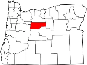
Crooked River Ranch is an unincorporated community and census-designated place (CDP) in southern Jefferson County, Oregon, United States.[3] A small portion of the ranch is also in north Deschutes County.[4] The Ranch is located between the Deschutes River and the Crooked River near the south end of Lake Billy Chinook.[5] It is west of U.S. Route 97 between Culver and Terrebonne. Amenities in the community include a golf course, swimming pool, tennis courts, saloon, disc golf course, horse riding arena and general store.[6] The 12,000-acre (49 km2) ranch has a population of approximately 5,000.[4] It is the largest homeowner association in Oregon.[6] Crooked River Ranch has a Terrebonne mailing address, but the postal service also allows mail addressed to Crooked River, Oregon or Crooked River Ranch, Oregon.[7] The ZIP code is 97760.[7]
Demographics
| Census | Pop. | Note | %± |
|---|---|---|---|
| 2020 | 4,912 | — | |
| U.S. Decennial Census[8][2] | |||
History
Prior to European Colonialism, this area was populated by groups of people from what is now known as the Confederated Tribes of Warm Springs.[9]
In 1910,[6] Hillsboro politician Harry V. Gates[10] bought the Crooked River Ranch property from local homesteaders and named it "Gates Ranch".[6] The main ranch house was built in 1916 and is currently in use as a senior center.[6] The property was named "Crooked River Ranch" as early as 1934.[10] In 1961 the ranch was sold to the Thomas Bell family, who operated it as the Z-Z Cattle Co. for the next 10 years.[6] In 1972 Crooked River Ranch was sold and developed as a recreational site.[6] In 1980, the ranch's zoning changed from recreational to rural/residential.[6] In 1992, the site was rezoned as a residential subdivision.[6]
Education
Primary and secondary school students in Crooked River Ranch are served by the Culver School District and the Redmond School District.[4]
See also
References
- ↑ "ArcGIS REST Services Directory". United States Census Bureau. Retrieved October 12, 2022.
- 1 2 "Census Population API". United States Census Bureau. Retrieved October 12, 2022.
- ↑ U.S. Geological Survey Geographic Names Information System: Crooked River Ranch
- 1 2 3 "Ranch Info". Crooked River Realty. Archived from the original on January 24, 2010. Retrieved December 3, 2009.
- ↑ Oregon Atlas & Gazetteer (7th ed.). Yarmouth, Maine: DeLorme. 2008. p. 43. ISBN 0-89933-347-8.
- 1 2 3 4 5 6 7 8 9 "Crooked River Ranch Club and Maintenance Organization". Retrieved December 3, 2009.
- 1 2 "United States Postal Service ZIP Code Lookup". Retrieved December 3, 2009.
- ↑ "Census of Population and Housing". Census.gov. Retrieved June 4, 2016.
- ↑ "NativeLand.ca". Native-land.ca - Our home on native land. Retrieved September 17, 2020.
- 1 2 Fourteenth annual report of the Federal Power Commission, fiscal year ended June 30, 1934, with additional activities to December 1, 1934. Serial Set Vol. No. 9968, Session Vol. No.56; Report: H.Doc. 26 (Report). January 3, 1935. pp. 216–217.
External links

