 | |
|---|---|
| Route information | |
| Length | 81.0 km (50.3 mi) |
| Major junctions | |
| From | Porozina ferry port, island of Cres (ferry link to the mainland) |
| To | Mali Lošinj |
| Location | |
| Country | Croatia |
| Counties | Primorje-Gorski Kotar |
| Highway system | |
Porozina ferry port, the northern terminus of D100
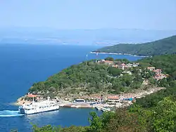
Cres, next to the D100 route

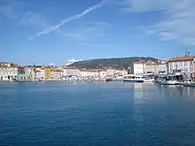
Mali Lošinj, at the southern terminus of D100
D100 is a state road in Croatia connecting Porozina ferry port - ferry access to Brestova on the mainland (via Jadrolinija)[1] (D402) and D101 state road to Cres and Mali Lošinj. The D100 road is carried between Cres and Lošinj islands via a swing bridge in Osor across a 12 m (39 ft) wide strait.[2] The road is 81.0 km long.[3]
The road, as well as all other state roads in Croatia, is managed and maintained by Hrvatske ceste, a state-owned company.[4]
Traffic volume
Traffic is regularly counted and reported by Hrvatske ceste, operator of the road.[5] Substantial variations between annual (AADT) and summer (ASDT) traffic volumes are attributed to the fact that the road carries substantial tourist traffic along Cres and Lošinj.
| D100 traffic volume | ||||
| Road | Counting site | AADT | ASDT | Notes |
| 4001 Predošćica | 978 | 3,122 | Between L58084 and D101 junctions. | |
| 4003 Ćunski | 2,166 | 4,383 | Between L58115 and Ž5157 junctions. | |
Road junctions and populated areas
| D100 junctions/populated areas | |
| Type | Slip roads/Notes |
| Porozina ferry port - Jadrolinija ferry access to the mainland port of Brestova[1] and D402 state road. Northern terminus of the road. | |
| L58084 to Beli | |
| Vodice | |
| Ž5124 to Cres | |
| L58096 to Loznati | |
| L58093 to Valun and Lubenice | |
| L58097 to Orlec | |
| L58100 to Vrana - the road actually loops from D100 to the village and back, forming two intersections with D100. | |
| Ž5137 to Martinšćica and Miholašćica | |
| Belej | |
| L58099 to Ustrine | |
| Osor - junction with L58101 to Punta Križa | |
| L58115 to Nerezine - the road actually loops from D100 to the settlement and back, forming three intersections with D100. | |
| Sveti Jakov | |
| Ž5157 to Lošinj Airport | |
| Ćunski | |
| L58103 to Artatore | |
| Mali Lošinj: Ž5158 to Mali Lošinj ferry port - Jadrolinija ferry access to Zadar[6] (D407) Ž5159 to Čikat and Sunčana Uvala resorts Ž5161 to Veli Lošinj Southern terminus of the road. | |
See also
Sources
- 1 2 3 "Jadolinija ferry service". May 11, 2010.
- ↑ "Osor bridge under reconstruction". Novi list (in Croatian). October 17, 2002.
- ↑ "Decision on categorization of public roads as state roads, county roads and local roads". Narodne novine (in Croatian). February 17, 2010.
- ↑ "Public Roads Act". Narodne novine (in Croatian). December 14, 2004.
- ↑ "Traffic counting on the roadways of Croatia in 2009 - digest" (PDF). Hrvatske ceste. May 1, 2010. Archived from the original (PDF) on July 21, 2011.
- ↑ "Jadrolinija ferry service". May 11, 2010.
This article is issued from Wikipedia. The text is licensed under Creative Commons - Attribution - Sharealike. Additional terms may apply for the media files.