Dampremy
| |
|---|---|
Former municipality of Belgium | |
 Coat of arms | |
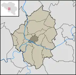 Location in the municipality of Charleroi | |
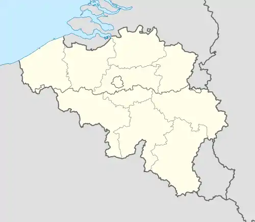 Dampremy Location in Belgium | |
| Coordinates: 50°24′N 4°26′E / 50.400°N 4.433°E | |
| Country | |
| Region | |
| Community | |
| Province | |
| Municipality | |
| Area | |
| • Total | 1.07 sq mi (2.77 km2) |
| Population (2001) | |
| • Total | 8,566 |
| Time zone | UTC+1 (CET) |
| • Summer (DST) | UTC+2 (CEST) |
| Postal code | 6020 |
| Area code | 071 |
Dampremy (Walloon: Dårmè) is a town of Wallonia and district of the municipality of Charleroi, located in the province of Hainaut, Belgium.
It was a municipality of its own before the fusion of the Belgian municipalities in 1977.
 Saint-Ghislain chapel.
%252C_Rue_Arthur_Decoux_(2).jpg.webp) Rue Arthur Decoux
Rue Arthur Decoux Former town hall.
Wikimedia Commons has media related to Dampremy.
This article is issued from Wikipedia. The text is licensed under Creative Commons - Attribution - Sharealike. Additional terms may apply for the media files.