Danwon-gu
단원구 | |
|---|---|
| Korean transcription(s) | |
| • Hanja | 檀園區 |
| • Revised Romanization | Danwon-gu |
| • McCune-Reischauer | Tanwǒn-gu |
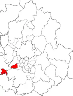 Map of Gyeonggi-do highlighting Danwon-gu. | |
| Coordinates: 37°19′08″N 126°48′43″E / 37.319°N 126.812°E | |
| Country | South Korea |
| Region | Sudogwon (SCA) |
| Province | Gyeonggi |
| City | Ansan |
| Administrative divisions | 12 dong |
| Area | |
| • Total | 91.23 km2 (35.22 sq mi) |
| Population (July 31, 2013) | |
| • Total | 371,434 |
| • Density | 4,100/km2 (11,000/sq mi) |
| • Dialect | Seoul |
| Website | Danwon-gu Office |
Danwon-gu (Korean: 단원구) is a district of the city of Ansan in Gyeonggi-do, South Korea. The name "Danwon" came from the nickname of Kim Hong Do, a famous Korean artist of the 18th century. The previous name of Kim Hong Do's hometown was "Ansan"; the residents wanted to rename the district so that it related to their great artist Kim Hong-do.[1]
Administrative divisions
Danwon-gu is divided into the following dongs:
| Name | Hangul | Hanja | Population[2] | Households | Area (km2)[3] |
|---|---|---|---|---|---|
| Wa-dong, Ansan | 와동 | 瓦洞 | 47,032 | 19,558 | 3.23 |
| Gojan 1-dong | 고잔 1동 | 古棧洞 | 23,955 | 9,167 | 1.75 |
| Gojan 2-dong | 고잔 2동 | 25,332 | 9,635 | 1.87 | |
| Hosu-dong | 호수동 | 湖水洞 | 44,986 | 14,808 | 2.48 |
| Wongokbon-dong | 원곡본동 | 元谷洞 | 51,582 | 15,264 | 8.12 |
| Wongok 1-dong | 원곡 1동 | 14,359 | 4,287 | 0.95 | |
| Wongok 2-dong | 원곡 2동 | 16,944 | 5,301 | 0.96 | |
| Choji-dong | 초지동 | 草芝洞 | 54,968 | 17,672 | 21.16 |
| Seonbu 1-dong | 선부 1동 | 仙府洞 | 19,205 | 7,466 | 0.86 |
| Seonbu 2-dong | 선부 2동 | 28,318 | 11,374 | 2.07 | |
| Seonbu 3-dong | 선부 3동 | 37,179 | 13,720 | 5.81 | |
| Daebu-dong | 대부동 | 大阜洞 | 7,574 | 3,766 | 42.37 |
See also
References
- ↑ Danwon-gu, Danwon-gu (2016-04-29). "name's origin, danwon-gu". Archived from the original on 2016-04-05. Retrieved 2016-04-28.
- ↑ http://stat.iansan.net/02_sub/body01.jsp?NT_ID=82&flag=VIEW&SEQ_ID=367103&page=1%5B%5D
- ↑ "안산시 통계". Archived from the original on 2013-09-05. Retrieved 2013-09-05.
External links

This article is issued from Wikipedia. The text is licensed under Creative Commons - Attribution - Sharealike. Additional terms may apply for the media files.