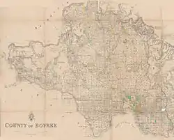
1866 map of County of Bourke. Dendy's Special Survey is south-east of Melbourne on the coast.
Dendy's Special Survey formed the basis for the settlement of Brighton. It covered the area now bounded by North Road; South Road; on the west by the Port Phillip Bay; and on the east by East Boundary Road. It includes: all of the Melbourne suburbs of Bentleigh, Brighton East, Ormond; and parts of Brighton, Bentleigh East and McKinnon.[1][2]
The Special Survey regulations determined that the land should:[2]
- be at least five miles (8 km) from Melbourne: North Road runs east–west on the survey Section line five miles (8 km) south of Batman's Hill
- have no more than two miles (3 km) of water-frontage: South Road runs east–west two miles (3 km) south of North Road
- have an area of eight square miles: so East Boundary Road runs north–south four miles (6 km) from the coast
As the alignment of East Boundary Road is determined by the coastline, it does not lie on a survey Section line and therefore isn't aligned with the Melbourne one-mile (1.6 km) survey grid.
References
This article is issued from Wikipedia. The text is licensed under Creative Commons - Attribution - Sharealike. Additional terms may apply for the media files.