| Devil's Den Nature Preserve | |
|---|---|
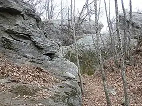
 Rock formations | |
 | |
| Location | Carroll County, Virginia, United States |
| Nearest town | Fancy Gap, Virginia |
| Coordinates | 36°38′41″N 80°42′12″W / 36.644585°N 80.703240°W |
| Area | 280 acres (110 ha) |
| Elevation | 2906 |

Top of rock formations
Devil's Den Nature Preserve is a 280-acre (113 ha) privately-owned nature preserve in Carroll County, Virginia.
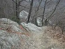
The preserve contains rugged rock formations on a ridge side, featuring a cave or rock shelter known as Devil's Den. The property was once the Robert S. Harris farm. .[1]
References
- ↑ Ostertag, Rhonda and George; Ostertag, George (2013-04-02). Hiking Connecticut and Rhode Island. Rowman & Littlefield. ISBN 978-0-7627-9375-4.
External links
- Virginia Department of Game and Inland Fisheries site: https://www.dgif.virginia.gov/vbwt/sites/devils-den-nature-preserve
This article is issued from Wikipedia. The text is licensed under Creative Commons - Attribution - Sharealike. Additional terms may apply for the media files.