| Middle Dnieper Hydroelectric Power Plant | |
|---|---|
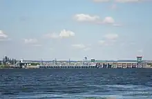 View of power station and dam | |
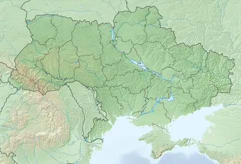 Location of Middle Dnieper Hydroelectric Power Plant in Ukraine | |
| Official name | Середньодніпровська ГЕС |
| Location | Kamianske, Ukraine |
| Coordinates | 48°32′52.80″N 34°32′28.67″E / 48.5480000°N 34.5412972°E |
| Purpose | Power, navigation |
| Status | Operational |
| Construction began | 1956 |
| Opening date | 1963 |
| Owner(s) | Ukrhydroenergo |
| Dam and spillways | |
| Type of dam | Earth-fill embankment with gravity sections |
| Impounds | Dnieper River |
| Height | 15.5 m (51 ft) |
| Length | 7,490 m (24,570 ft) |
| Reservoir | |
| Creates | Kamianske Reservoir |
| Total capacity | 2,450,000,000 m3 (1,986,247 acre⋅ft) |
| Surface area | 567 km2 (219 sq mi) |
| Power Station | |
| Operator(s) | Ukrhydroenergo |
| Commission date | 1963-1964 |
| Turbines | 8 x 44 MW propeller |
| Installed capacity | 352 MW |
| Annual generation | 1.4 TWh |
The Middle Dnieper Hydroelectric Station is a run-of-river power plant on the Dnieper River in Kamianske, Ukraine, operated by Ukrhydroenergo.[1]
The primary purpose of the dam is hydroelectric power generation and navigation. It is the fourth dam in the Dnieper cascade. The dam has an associated lock and a power station with an installed capacity of 352 MW. Construction on the dam began in 1956 and the last generator was commissioned in 1964.[2] Until 2016 the plant was named Dniprodzerzhynska HES, after the Soviet name of the town of Kamianske.
See also
References
- ↑ "Середньодніпровська ГЕС" (in Ukrainian). UHE. Retrieved 10 August 2022.
- ↑ "Hydroelectric Power Plants in Ukraine". IndustCards. Archived from the original on 8 December 2012. Retrieved 28 February 2014.
External links
| Tributaries1 |  | |
|---|---|---|
| Reservoirs | ||
| Hydroelectric stations | ||
| Canals |
| |
| Cities | ||
| Crossings | ||
| ||
This article is issued from Wikipedia. The text is licensed under Creative Commons - Attribution - Sharealike. Additional terms may apply for the media files.