| Eel River | |
|---|---|
 Collamer Dam | |
 | |
| Native name | Kineepikwameekwa Siipiiwi (Miami-Illinois) |
| Location | |
| Country | United States |
| State | Indiana |
| Physical characteristics | |
| Source | |
| • location | Huntertown, Indiana |
| Mouth | Wabash River |
• location | Logansport, Indiana |
| Discharge | |
| • location | mouth |
| • average | 848.48 cu ft/s (24.026 m3/s) (estimate)[3] |
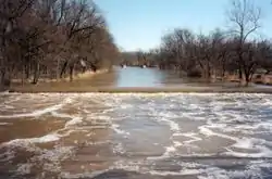
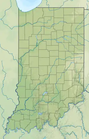
The Eel River is a 94-mile-long (151 km)[4] tributary of the Wabash River in northern Indiana in the United States. Via the Wabash and Ohio rivers, its waters flow to the Mississippi River and ultimately the Gulf of Mexico. The Eel River rises southeast of Huntertown in Allen County and flows southwest through Allen, Whitley, Kosciusko, Wabash, Miami, and Cass counties to join the Wabash at Logansport. The river was called Kineepikwameekwa Siipiiwi - "river of the snake fish" by the Miami people, who inhabited the area at the time of European contact, the English rendered it as Ke-na-po-co-mo-co. It is the northern of the two rivers named Eel River within Indiana.
Origins and history
Natural history
Originating as an "ice-marginal channel" at the edge of the retreating Saginaw Lobe of the Wisconsin Glacier, the Eel River was later buried by the glacier's advancing Erie Lobe.[5] As the Erie Lobe retreated, the Eel formed a single stream with what is now upper Cedar Creek in DeKalb and Allen counties. The ancestral Eel River was also fed by glacial meltwater surging under the ice from the southeast through a "tunnel valley" known today as Cedar Creek Canyon.[6] Blockage of the Eel's channel by outwash from the canyon and a decline in the volume of meltwater forced the upper Eel to change course into the canyon, creating today's Cedar Creek.[6] This is a classic example of stream piracy that shifted almost 175,000 acres (710 km2) of land from the Eel-Wabash watershed to that of the St. Joseph-Maumee.[6][7]
Indigenous peoples and French exploration
The waterways were where indigenous peoples settled in prehistoric and historic times, as they were sources of food and water, and the avenues for transportation and trade. The Miami, an Algonquian-speaking people, called the river Kineepikwameekwa Siipiiwi or Ke-na-po-co-mo-co, meaning "river of the snake fish."[8][9] Later French explorers, who also followed the waterways, called it the Rivière L'Anguille (Eel River).

Political and military history
Before the United States consolidated its hold on the Northwest Territory, the Eel formed a rough boundary between the Potawatomi tribe on the north and the Miami tribe on the south.[10] In addition, it was an area of competition between French and British colonial forces for decades before the American Revolution. Afterward, the US fought with American Indians in numerous battles sometimes called the Northwest Indian War.
In November 1780, a French militia force under Auguste Mottin de la Balme,[11] who planned to seize a British trading post on the Eel near present-day Columbia City, was destroyed by the Miami led by Chief Michikinikwa, also known as "Little Turtle".[12] On 19 October 1790, Chief Michikinikwa's warriors surprised and virtually annihilated a U.S. force under Colonel John Hardin in the Eel bottomlands southeast of present-day Churubusco.[13]
On 7 August 1791, the Eel was the scene of another battle, when General James Wilkinson destroyed the Miami town of Kenapacomaqua 6 miles (9.7 km) upstream from present-day Logansport.[14][15][16][17]
In September 1812, Colonel James Simrall, acting under orders from General William Henry Harrison, ravaged Miami farms and villages along the Eel in present-day Whitley County. He defeated a Miami force that stood and fought.[18][19]
Literary reference
Ross Lockridge Jr., Raintree County, Boston: Houghton Mifflin (1948), pp. 93–94.
Johnny Shawnessy probably had a better guess about the river's name than anyone else as he was the only person in the County for years who made any research into the Indian culture. He finally decided that the river's name was related to the Indian word Shakamak, meaning long fish or eel. There was a Shakamak River in southern Indiana; and in the northern part of the state, an Eel River, which in the Miami tongue had been called the Kenapocomoko, or River of Snake Fish. The only drawback to Johnny's theory was the fact that he never found an eel in the Shamucky River.

See also
Notes and references
- ↑ "The Indians Called It Kenapocomoco". Lenape Talking Dictionary. 1991. Retrieved 2023-12-13.
- ↑ "Eel River (Indiana)". Lenape Talking Dictionary. 2023. Retrieved 2023-12-13.
- ↑ United States Environmental Protection Agency. "Watershed Report: Eel River". WATERS GeoViewer. Archived from the original on 2021-07-17. Retrieved 2021-07-17.
- ↑ U.S. Geological Survey. National Hydrography Dataset high-resolution flowline data. The National Map Archived 2012-03-29 at the Wayback Machine, accessed May 19, 2011
- ↑ Water Resource Availability. 1996, p. 46
- 1 2 3 Water Resource Availability. 1996, p. 47
- ↑ p. 121.
- ↑ Winger 1934, p. 3. The author, a professor of history at Manchester College, notes that the original form of the word was Kenapekwamakwah or Kineepikwameekwa ("Snake-Fish-Town" or "Eel River Village"), the name of the main village of the ″Kilatika Miami″or ″Eel River Miami Band″.
- ↑ Winger 1939, p. 63. The author notes that the name is Miami in origin.
- ↑ Winger 1939, pp. 63-64.
- ↑ Magnin, Frédéric (2005). Mottin de la Balme, cavalier des deux mondes et de la liberté, Paris: L'Harmattan, ISBN 2-7475-9080-1.
- ↑ Winger 1934, pp. 5-6.
- ↑ Winger 1934, pp. 4-5.
- ↑ Barce, Elmore, The Land of the Miamis, Fowler, IN: The Benton Review Shop, 1922, pp. 188-194.
- ↑ Wilkinson's account of this expedition is found at American State Papers, Indian Affairs, March 3, 1789 to March 3, 1815, vol. 1, p. 134 Archived June 13, 2008, at the Wayback Machine, Indiana University, Glenn Black Laboratory.
- ↑ Another account is found in James Handasyd Perkins and John Mason Peck, Annals of the West (1857) pp. 569-570.
- ↑ Known locally as the Battle of Olde Towne, Wilkinson's raid is also described at on the Cass County, Indiana USGenWeb site.
- ↑ Winger 1934, p. 9
- ↑ "Eel River Battlefield War of 1812", Historical Marker Database
Bibliography
- "Water Resource Availability in the Maumee River Basin, Indiana, Water Resource Assessment 96-5" (PDF). Indianapolis:Indiana Department of Natural Resources, Division of Water. 1996. Retrieved 19 May 2017.
- Winger, Otho (1934). The Ke Na Po Co Mo Co: Eel River, the Home of Little Turtle. Whitley County Historical Society.
- Winger, Otho (1939). The Potawatomi Indians (1961 reprint ed.). The Elgin Press.
External links
- Sequential Development of Eel River and Cedar Creek
- Little Turtle, the Great Eel River Chief DEAD LINK
- The Eel River Post and Fort DEAD LINK
- Along the Eel DEAD LINK
- Introduction to the Eel River DEAD LINK
- The Eel River of Northern Indiana DEAD LINK
- U.S. Geological Survey Geographic Names Information System: Eel River
