Ephrata Municipal Airport Ephrata Army Airfield | |||||||||||||||||||
|---|---|---|---|---|---|---|---|---|---|---|---|---|---|---|---|---|---|---|---|
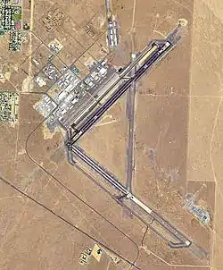
 USGS 2006 orthophoto | |||||||||||||||||||
| Summary | |||||||||||||||||||
| Airport type | Public | ||||||||||||||||||
| Operator | Port District No. 9 of Grant County | ||||||||||||||||||
| Serves | Ephrata, Washington | ||||||||||||||||||
| Elevation AMSL | 1,276 ft / 389 m | ||||||||||||||||||
| Coordinates | 47°18′29″N 119°31′01″W / 47.30806°N 119.51694°W | ||||||||||||||||||
| Website | PortOfEphrata.com | ||||||||||||||||||
| Map | |||||||||||||||||||
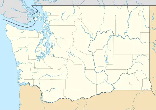
 EPH Location of airport in Washington  EPH EPH (the United States) | |||||||||||||||||||
| Runways | |||||||||||||||||||
| |||||||||||||||||||
| Statistics (2010) | |||||||||||||||||||
| |||||||||||||||||||
Ephrata Municipal Airport (IATA: EPH, ICAO: KEPH, FAA LID: EPH) is a public use airport located 4 km (2.5 mi) southeast of the central business district of Ephrata, a city in Grant County, Washington, United States.[1] It is included in the National Plan of Integrated Airport Systems for 2011–2015, which categorized it as a general aviation airport.[2]
History
The airfield was established in 1939 as Ephrata Army Air Base. It was used initially as a support airfield for bombing and gunnery ranges in the area (Seven Mile Gunnery School). Transferred to Fourth Air Force in 1940 as a group training airfield for B-17 Flying Fortress heavy bombardment units (including the 401st Bombardment Group), with new aircraft being obtained from Boeing near Seattle. Later it was reassigned to Second Air Force when heavy bombardment group training was reassigned to that command. It was also used by Air Technical Service Command as an aircraft maintenance and supply depot. On 25 September 1945, Major General Willis H. Hale, Fourth Air Force, notified Ephrata Army Air Base that it was temporarily deactivated,[3] and it was turned over to War Assets Administration (WAA) for disposal. It was transferred to Grant County and developed into a commercial airport in the late 1940s.
Parts of the 1989 Steven Spielberg film Always were filmed on the airport.
Facilities and aircraft
Ephrata Municipal Airport covers an area of 2,300 acres (931 ha) at an elevation of 1,276 feet (389 m) above mean sea level. It has three asphalt paved runways: 3/21 is 5,500 by 75 feet (1,676 x 23 m); 4/22 is 3,467 by 150 feet (1,057 x 46 m); 11/29 is 3,843 by 60 feet (1,171 x 18 m).[1]
For the 12-month period ending June 28, 2010, the airport had 135,140 general aviation aircraft operations, an average of 370 per day. At that time there were 72 aircraft based at this airport: 24% single-engine, 7% multi-engine, and 69% glider.[1]
Cargo Carriers
| Airlines | Destinations |
|---|---|
| Ameriflight | Portland (OR), Seattle-Boeing |
See also
References
![]() This article incorporates public domain material from the Air Force Historical Research Agency
This article incorporates public domain material from the Air Force Historical Research Agency
- 1 2 3 4 FAA Airport Form 5010 for EPH PDF. Federal Aviation Administration. Effective April 5, 2012.
- ↑ "2011–2015 NPIAS Report, Appendix A" (PDF). National Plan of Integrated Airport Systems. Federal Aviation Administration. October 4, 2010. Archived from the original (PDF, 2.03 MB) on 2012-09-27.
- ↑ Associated Press, "Two Airfields In Desert Area Are Inactivated - Victorville, Daggett Bases Temporarily Suspend Operations", The San Bernardino Daily Sun, San Bernardino, California, Thursday 27 September 1945, Volume 52, page 6.
External links
- Port of Ephrata: Port District #9 of Grant County, Washington
- WSDOT Pilot's Guide: "Ephrata Municipal" (PDF).
- WSDOT Economic Impacts: "Ephrata Municipal Airport" (PDF).
- Aerial image as of July 1996 from USGS The National Map
- FAA Terminal Procedures for EPH, effective December 28, 2023
- Resources for this airport:
- FAA airport information for EPH
- AirNav airport information for KEPH
- ASN accident history for EPH
- FlightAware airport information and live flight tracker
- NOAA/NWS weather observations: current, past three days
- SkyVector aeronautical chart, Terminal Procedures
.svg.png.webp)
