Erxleben | |
|---|---|
 | |
 Coat of arms | |
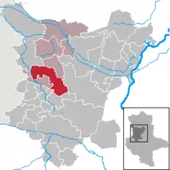
Location of Erxleben within Börde district  | |
 Erxleben  Erxleben | |
| Coordinates: 52°13′N 11°15′E / 52.217°N 11.250°E | |
| Country | Germany |
| State | Saxony-Anhalt |
| District | Börde |
| Municipal assoc. | Flechtingen |
| Government | |
| • Mayor (2021–28) | Christian Jungenitz[1] |
| Area | |
| • Total | 83.39 km2 (32.20 sq mi) |
| Elevation | 128 m (420 ft) |
| Population (2021-12-31)[2] | |
| • Total | 2,799 |
| • Density | 34/km2 (87/sq mi) |
| Time zone | UTC+01:00 (CET) |
| • Summer (DST) | UTC+02:00 (CEST) |
| Postal codes | 39343 |
| Dialling codes | 039052, 039050, 039052, 039062, 039409 |
| Vehicle registration | BK |
Erxleben is a municipality in the Börde district in Saxony-Anhalt, Germany. On 31 December 2009 it absorbed the former municipality Bregenstedt,[3] followed by the former municipalities Bartensleben, Hakenstedt and Uhrsleben on 1 January 2010.[4] The municipality consists of the Ortsteile (municipal divisions) Bregenstedt, Erxleben, Groß Bartensleben, Groppendorf, Hakenstedt, Klein Bartensleben and Uhrsleben.
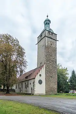
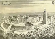
Erxleben Castle was owned by the House of Alvensleben from around 1270 until expropriation in 1945 by communist East Germany.
 Erxleben Castle
References
- ↑ Bürgermeisterwahlen in den Gemeinden, Endgültige Ergebnisse, Statistisches Landesamt Sachsen-Anhalt, accessed 3 February 2022.
- ↑ "Bevölkerung der Gemeinden – Stand: 31. Dezember 2021" (PDF) (in German). Statistisches Landesamt Sachsen-Anhalt. June 2022.
- ↑ Gebietsänderungen vom 02. Januar bis 31. Dezember 2009, Statistisches Bundesamt
- ↑ Gebietsänderungen vom 01. Januar bis 31. Dezember 2010, Statistisches Bundesamt
This article is issued from Wikipedia. The text is licensed under Creative Commons - Attribution - Sharealike. Additional terms may apply for the media files.