| Florida's 26th congressional district | |||
|---|---|---|---|
Interactive map of district boundaries since January 3, 2023 | |||
| Representative |
| ||
| Area | 5,171[1] sq mi (13,390 km2) | ||
| Distribution |
| ||
| Population (2022) | 796,673[3] | ||
| Median household income | $67,071[3] | ||
| Ethnicity |
| ||
| Cook PVI | R+8[4] | ||
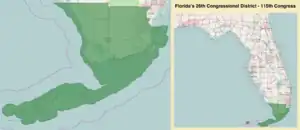
Florida's 26th congressional district is an electoral district for the U.S. Congress, which was first created in South Florida in 2013 as a result of Florida's population gain in the 2010 census.[5] In the 2020 redistricting cycle, it was drawn as a successor to the previous 25th district and includes most of inland Collier County as well as the northwestern suburbs of Miami, including Doral, Hialeah, Miami Lakes, and some neighborhoods in Miami itself, such as Allapattah and Wynwood. The previous iteration of the 26th district, which included Monroe County and the southwestern suburbs of Miami, was instead renamed as the newly-created 28th district.
From 2013 to 2023, the 26th district was located in far South Florida, and contains all of Monroe County as well as a portion of south-west Miami-Dade County.[6][7] Geographically, it was the successor to the old 25th District and included Homestead, Key Largo, Marathon, and Key West, as well as Florida International University, Key West International Airport, and all three of Florida's national parks.
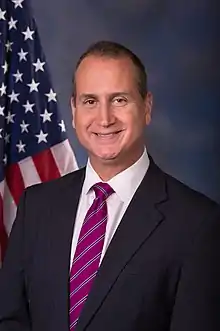
Republican Mario Díaz-Balart currently represents the district.
Characteristics
According to the APM Research Lab's Voter Profile Tools (featuring the U.S. Census Bureau's 2019 American Community Survey), the district contained about 482,000 potential voters (citizens, age 18+). Of these, 68% are Latino, 18% White, and 12% Black. Nearly half (49%) of the district's potential voters are immigrants. The median income among households (with one or more potential voter) in the district is about $68,200, while 11% of households live below the poverty line. As for the educational attainment of potential voters in the district, 15% of those 25 and older have not earned a high school degree, while 28% hold a bachelor's or higher degree.
Voting
Presidential election results
Results from previous presidential elections. Florida's 26th district was the only congressional district to vote for the Democratic candidate for President in 2012 and 2016, then flip to the Republican candidate (Donald Trump) in 2020.[8]
| Year | Office | Results |
|---|---|---|
| 2012 | President | Barack Obama 55.4% - Mitt Romney 43.9% |
| 2016 | President | Hillary Clinton 56.7% - Donald Trump 40.6% |
| 2020 | President | Donald Trump 52.4% - Joe Biden 46.9% |
State election results
Results from previous non-presidential statewide elections
| Year | Office | Results |
|---|---|---|
| 2016 | Senate | Marco Rubio 49.4% - Patrick Murphy 48.1% |
| 2018 | Senate | Bill Nelson 54.4% - Rick Scott 45.6% |
| Governor | Andrew Gillum 53.5% - Ron DeSantis 45.3% | |
| Attorney General | Sean Shaw 52.0% - Ashley Moody 45.9% | |
| 2022 | Senate | Marco Rubio 69.6% - Val Demings 29.7% |
| Governor | Ron DeSantis 70.1% - Charlie Crist 29.4% | |
List of members representing the district
| Representative | Party | Years | Cong ress |
Electoral history | Geography |
|---|---|---|---|---|---|
| District created January 3, 2013 | |||||
 Joe Garcia (Miami) |
Democratic | January 3, 2013 – January 3, 2015 |
113th | Elected in 2012. Lost re-election. |
2013–2017.tif.png.webp) |
 Carlos Curbelo (Miami) |
Republican | January 3, 2015 – January 3, 2019 |
114th 115th |
Elected in 2014. Re-elected in 2016. Lost re-election. | |
2017–2023 | |||||
 Debbie Mucarsel-Powell (Miami) |
Democratic | January 3, 2019 – January 3, 2021 |
116th | Elected in 2018. Lost re-election. | |
 Carlos Giménez (Miami) |
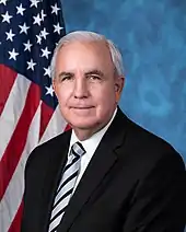
Republican | January 3, 2021 – January 3, 2023 |
117th | Elected in 2020. Redistricted to the 28th district. | |
 Mario Díaz-Balart (Miami) |
Republican | January 3, 2023 – present |
118th | Redistricted from the 25th district and re-elected in 2022. | 2023–present:.svg.png.webp) Most of inland Collier County and the northwest of Miami-Dade County |
Election results
2012
| Party | Candidate | Votes | % | |
|---|---|---|---|---|
| Democratic | Joe Garcia | 135,694 | 53.6 | |
| Republican | David Rivera | 108,820 | 43.0 | |
| Total votes | 252,957 | 100.0 | ||
2014
| Party | Candidate | Votes | % | |
|---|---|---|---|---|
| Republican | Carlos Curbelo | 83,031 | 51.5 | |
| Democratic | Joe Garcia (Incumbent) | 78,306 | 48.5 | |
| Total votes | 161,337 | 100.0 | ||
| Republican gain from Democratic | ||||
2016
| Party | Candidate | Votes | % | |
|---|---|---|---|---|
| Republican | Carlos Curbelo (Incumbent) | 148,547 | 53.0 | |
| Democratic | Joe Garcia | 115,493 | 41.2 | |
| Total votes | 280,542 | 100.0 | ||
| Republican hold | ||||
2018
| Party | Candidate | Votes | % | |
|---|---|---|---|---|
| Democratic | Debbie Mucarsel-Powell | 119,797 | 50.9 | |
| Republican | Carlos Curbelo (Incumbent) | 115,678 | 49.1 | |
| Total votes | 235,475 | 100.0 | ||
| Democratic gain from Republican | ||||
2020
| Party | Candidate | Votes | % | |
|---|---|---|---|---|
| Republican | Carlos A. Giménez | 177,211 | 51.7 | |
| Democratic | Debbie Mucarsel-Powell (Incumbent) | 165,377 | 48.3 | |
| Total votes | 342,588 | 100.0 | ||
| Republican gain from Democratic | ||||
2022
| Party | Candidate | Votes | % | |
|---|---|---|---|---|
| Republican | Mario Díaz-Balart (incumbent) | 143,240 | 70.8 | |
| Democratic | Christine Olivo | 58,868 | 29.1 | |
| Total votes | 202,108 | 100.0 | ||
| Republican hold | ||||
References
- ↑ "Congressional Plan--SC14-1905 (Ordered by The Florida Supreme Court, 2-December-2015)" (PDF). Florida Senate Committee on Reapportionment. Retrieved January 11, 2017.
- ↑ Geography, US Census Bureau. "Congressional Districts Relationship Files (state-based)". www.census.gov.
- 1 2 Bureau, Center for New Media & Promotion (CNMP), US Census. "My Congressional District". www.census.gov.
{{cite web}}: CS1 maint: multiple names: authors list (link) - ↑ "2022 Cook PVI: District Map and List". Cook Political Report. Retrieved January 10, 2023.
- ↑ "Census 2010 shows Red states gaining congressional districts". Washington Post. Retrieved December 21, 2010.
- ↑ See whole Florida state map for 2013, with the 26th district covering Monroe County and Miami-Dade County: h9047_35x42L.pdf Congressional Plan: H000C9047. Chapter No. 2012-2, Laws of Florida. www.flsenate.gov. February 16, 2012.
- ↑ See the 2013 boundaries of the 26th district, covering Monroe County and western Miami-Dade in the 2013 districts map: H000C9047_map_se.pdf, for the southeast region of Florida. Congressional Plan: H000C9047. Chapter No. 2012-2, Laws of Florida. www.flsenate.gov. February 2012.
- ↑ "Just 47 House districts flipped in the last three presidential elections. What do they tell us?".
.svg.png.webp)