Kushalanagar | |
|---|---|
Town | |
| Kushalanagara | |
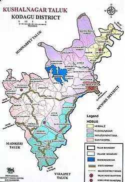
 Kushalanagar Taluk Map | |
| Nickname: Gateway of Kodagu | |
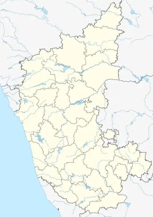
 Kushalanagar Location in Karnataka, India  Kushalanagar Kushalanagar (India) | |
| Coordinates: 12°27′27″N 75°57′37″E / 12.457434°N 75.960332°E | |
| Country | |
| State | Karnataka |
| District | Kodagu |
| Government | |
| • Body | Town Municipal Council |
| • Administrator | Dr.Yathish Ullal K.A.S |
| • Chief Officer | Krishna Prasad |
| Area | |
| • Town | 20 km2 (8 sq mi) |
| Elevation | 844 m (2,769 ft) |
| Population (2015) | |
| • Town | 68,290 |
| • Density | 3,400/km2 (8,800/sq mi) |
| • Metro | 80,000 |
| Languages | |
| • Official | Kannada |
| Time zone | UTC+5:30 (IST) |
| PIN | 571 234 |
| Telephone code | 08276 |
| ISO 3166 code | IN-KA |
| Vehicle registration | KA-12 |
| Website | www |
Kushalanagar or Kushalanagara is a city located in the Kodagu district of the Indian state of Karnataka. Surrounded by Kaveri river, it is the gateway to Kodagu district. It also serves as the headquarters of Kushalanagar Taluk.[1] By population, Kushalanagar is the second largest town in Kodagu district after Madikeri and the fastest developing town in the district. Kushalnagar is an important commercial centre in Kodagu.[2][3]
Etymology
According to popular myth, the name was given by Hyder Ali who was camped there when he received news of the birth of his son Tipu and called it as Kushyal nagar (="town of gladness")[4] But in reality, Tipu was born around 1750 while Hyder Ali entered Kodagu for the first time in the 1760s. After the British conquest of Coorg it was known as Fraserpet after Colonel James Stuart Fraser who was the Political Agent in Coorg around 1834.[5]
Geography
Kushalanagar is located at 12°28′N 75°58′E / 12.47°N 75.97°E.[6] It has an average elevation of 844 metres (2726 feet).[7]
Kushalanagar is situated in the eastern part of Kodagu district. The town is generally flat, although a few areas are hilly. Kaveri river surrounds the town in all directions except the west. It is roughly 85 kilometres west of Mysuru, 220 kilometres west of Bengaluru and 170 kilometres east of Mangaluru.
Demographics
As of 2011 India census,[8] Kushalanagara had a population of 15,326. [9] Males constitute 53% of the population and females 47%. Kushalanagar has an average literacy rate of 89.53%, higher than the state average of 75.36% male literacy is 82%, and female literacy is 73%. 12% of the population is under 6 years of age.
Kushalnagar along with its cluster of nearby villages including Mullusoge, Kudamangalore and Kudige form one of the most densely populated areas in the district with combined population of 39,393.[10]
The conurbation of Kushalnagar measures nearly 35km2, making it largest urban settlement in the district.
Economy
Kushalnagar is an important commercial centre in Kodagu.[2] KIADB Industrial Area is located in Kudloor of Kushalnagar where multiple coffee processing industries are located.[11]
Education
Kushalanagara has an average literacy rate of 89%. The town has six private Schools, one government school (from kindergarten to degree), one polytechnic school, and city has one government engineering college affiliated to VTU. A Sainik School is located in the outrange of the town, where students receive military training.
Tourist places
- Harangi Dam
- Nisargadhama
- Pushpagiri Wildlife Sanctuary
- Dubare Elephant Camp
- Mallalli Falls
Transport
KSRTC has a bus station here. They connect the town to metropolitan cities like Bengaluru & KIAL, Mysuru, Mangaluru, Ernakulam, Madurai, Coimbatore, Hubballi and many other smaller cities. The nearest railway stations are K R Nagar at a distance of 60 kms and Mysuru at the distance of 85 kms.
There is no railway service in Kodagu. A railway line from Mysuru to Kushalnagar has been planned but has been opposed by environmental activists.[12] The nearest airport is at Mysore, and the nearest international airport is Kannur International Airport. The Airports Authority of India has proposed a construction of a new mini airport named Kushalnagar airport in the town to boost tourism from other parts of the state.[13]
See also
References
- ↑ "Kushalnagar Taluk formed; Kodagu now has five taluks". Star of Mysore. 1 January 2021. Retrieved 9 January 2022.
- 1 2 "After Ponnampet, Kushalnagar may soon get taluk status". The Hindu. 30 November 2020. ISSN 0971-751X. Retrieved 30 December 2020.
- ↑ "Upgrading from Town Panchayath to Town Municipal Council". Retrieved 15 July 2023.
- ↑ Anonymous (1855). A gazetteer of Southern India. Madras: Pharoah and Co. p. 580.
- ↑ Anon. 1908 The Imperial Gazetteer of India. Vol. 11. Oxford. page 12
- ↑ "Maps, Weather, and Airports for Kushalnagar, India". www.fallingrain.com.
- ↑ "Elevation of Kushalnagar". Archived from the original on 21 May 2019. Retrieved 15 October 2017.
- ↑ "Census of India 2001: Data from the 2001 Census, including cities, villages and towns (Provisional)". Census Commission of India. Archived from the original on 16 June 2004. Retrieved 1 November 2008.
- ↑ "Census Data Handbook 2011" (PDF). Retrieved 31 July 2023.
- ↑ "Census 2011 Kodagu" (PDF).
- ↑ "Kushalnagar to get new industries". The Hindu. 19 November 2020. ISSN 0971-751X. Retrieved 30 December 2020.
- ↑ Bhardwaj, Meena (6 March 2019). "Environmentalists oppose proposed Mysuru-Kushalnagar rail line". New Indian Express. Retrieved 25 January 2021.
- ↑ "Funds sought for airport expansion, Kushalnagar railway line". The Hindu. 2 March 2020. ISSN 0971-751X. Retrieved 30 December 2020.