Frontenac | |
|---|---|
 | |
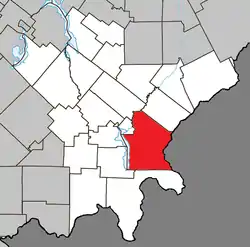 Location within Le Granit RCM | |
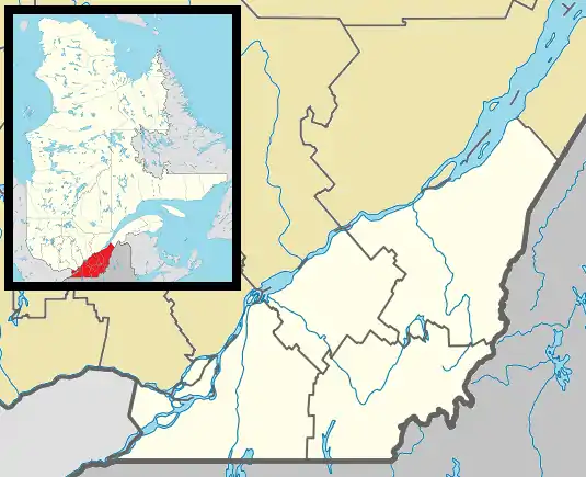 Frontenac Location in southern Quebec | |
| Coordinates: 45°35′N 70°50′W / 45.58°N 70.83°W[1] | |
| Country | |
| Province | |
| Region | Estrie |
| RCM | Le Granit |
| Constituted | January 1, 1882 |
| Government | |
| • Mayor | Jean-Denis Cloutier |
| • Federal riding | Mégantic—L'Érable |
| • Prov. riding | Mégantic |
| Area | |
| • Total | 244.60 km2 (94.44 sq mi) |
| • Land | 222.73 km2 (86.00 sq mi) |
| Population | |
| • Total | 1,650 |
| • Density | 7.4/km2 (19/sq mi) |
| • Pop 2006-2011 | |
| • Dwellings | 885 |
| Time zone | UTC−5 (EST) |
| • Summer (DST) | UTC−4 (EDT) |
| Postal code(s) | |
| Area code | 819 |
| Highways | |
| Website | www |
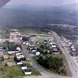
Frontenac is a municipality in Le Granit Regional County Municipality in Estrie, Quebec, Canada, on the Canada–United States border. Its population was 1,650 as of the Canada 2011 Census.
Toponymy
The area was settled heavily from 1870 to 1880 by colonizers from the United Kingdom and the United States. As such, it was known until 1959 as the united counties of Spaulding and Ditchfield (cantons unis de Spaulding-et-Ditchfield). The municipality was renamed in honour of Louis de Buade de Frontenac, a governor general of New France who played a significant role in the development of the colony. Today's population is predominantly French-speaking.
See also
References
- ↑ "Banque de noms de lieux du Québec: Reference number 24068". toponymie.gouv.qc.ca (in French). Commission de toponymie du Québec.
- 1 2 "Répertoire des municipalités: Geographic code 30025". www.mamh.gouv.qc.ca (in French). Ministère des Affaires municipales et de l'Habitation.
- 1 2 "Frontenac, Quebec (Code 2430025) Census Profile". 2011 census. Government of Canada - Statistics Canada.
External links
 Media related to Frontenac, Quebec at Wikimedia Commons
Places adjacent to Frontenac, Quebec | |
|---|---|
| Cities | |
|---|---|
| Municipalities | |
| Parishes | |
| Townships | |
| |
This article is issued from Wikipedia. The text is licensed under Creative Commons - Attribution - Sharealike. Additional terms may apply for the media files.