Viseu Dão Lafões | |
|---|---|
 | |
| Coordinates: 40°39′N 7°55′W / 40.65°N 7.91°W | |
| Country | |
| Region | Centro |
| Seat | Viseu |
| Municipalities | 14 |
| Area | |
| • Total | 3,237.74 km2 (1,250.10 sq mi) |
| Population (2011) | |
| • Total | 267,633 |
| • Density | 83/km2 (210/sq mi) |
| Time zone | UTC±00:00 (WET) |
| • Summer (DST) | UTC+01:00 (WEST) |
| Website | cimvdl |
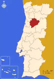
The Comunidade Intermunicipal Viseu Dão Lafões (Portuguese pronunciation: [viˈzew ðɐ̃w lɐˈfõjʃ]) is an administrative division in Portugal. It replaced the previously existing Greater Metropolitan Area of Viseu. Since January 2015, Viseu Dão Lafões is also a NUTS3 subregion of Centro Region, that covers the same area as the intermunicipal community.[1] The main city and seat of the intermunicipal community is Viseu. The population in 2011 was 267,633,[2] in an area of 3,237.74 km².[3]
Municipalities
The intermunicipal community Viseu Dão Lafões consists of 14 municipalities:[4]
| Municipality | Population (2011)[2] | Area (km²)[3] |
|---|---|---|
| Aguiar da Beira | 5,473 | 206.77 |
| Carregal do Sal | 9,835 | 116.89 |
| Castro Daire | 15,339 | 379.04 |
| Mangualde | 19,880 | 219.26 |
| Nelas | 14,037 | 125.71 |
| Oliveira de Frades | 10,261 | 145.35 |
| Penalva do Castelo | 7,956 | 134.34 |
| Santa Comba Dão | 11,597 | 111.95 |
| São Pedro do Sul | 16,851 | 348.95 |
| Sátão | 12,444 | 201.94 |
| Tondela | 28,946 | 371.22 |
| Vila Nova de Paiva | 5,176 | 175.53 |
| Viseu | 99,274 | 507.10 |
| Vouzela | 10,564 | 193.69 |
| Total | 267,633 | 3,237.74 |
References
- ↑ Adequação dos indicadores à nova organização territorial NUTS III / Entidades Intermunicipais, Instituto Nacional de Estatística, 18 March 2015
- 1 2 Instituto Nacional de Estatística
- 1 2 Áreas das freguesias, concelhos, distritos e país
- ↑ "Law nr. 75/2013" (pdf). Diário da República (in Portuguese). Assembly of the Republic (Portugal). Retrieved 14 August 2014.
External links
| North Region |
| ||||
|---|---|---|---|---|---|
| Centro Region |
| ||||
| Lisbon Region |
| ||||
| Alentejo Region |
| ||||
| Algarve Region |
| ||||
| Autonomous Regions | |||||
All these divisions are further subdivided into municipalities and parishes. | |||||
This article is issued from Wikipedia. The text is licensed under Creative Commons - Attribution - Sharealike. Additional terms may apply for the media files.