Grötzingen | |
|---|---|
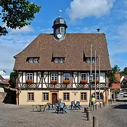 Grötzingen town hall | |
 Coat of arms | |
Location of Grötzingen in Karlsruhe 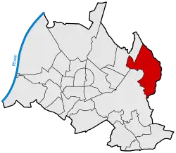 | |
 Grötzingen 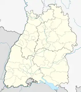 Grötzingen | |
| Coordinates: 49°00′34″N 08°29′44″E / 49.00944°N 8.49556°E | |
| Country | Germany |
| State | Baden-Württemberg |
| Admin. region | Karlsruhe |
| District | Urban district |
| City | Karlsruhe |
| Area | |
| • Total | 11.3358 km2 (4.3768 sq mi) |
| Population (2020-12-31)[1] | |
| • Total | 9,156 |
| • Density | 810/km2 (2,100/sq mi) |
| Time zone | UTC+01:00 (CET) |
| • Summer (DST) | UTC+02:00 (CEST) |
| Postal codes | 76229 |
| Dialling codes | 0721 |
Grötzingen is a town and eastern suburb of Karlsruhe, Germany. On 31 December 2020 it had a population of 9,156.[1] It contains Augustenburg Castle, a church. Pfinztal lies just to the southeast.
See also
References
- 1 2 "Die Karlsruher Bevölkerung im IV. Quartal 2020" (PDF). Stadt Karlsruhe. Retrieved 24 September 2021.
External links
Wikimedia Commons has media related to Grötzingen.
This article is issued from Wikipedia. The text is licensed under Creative Commons - Attribution - Sharealike. Additional terms may apply for the media files.