18°30′20″N 73°51′39″E / 18.505555°N 73.860755°E
Guruwar Peth | |
|---|---|
Neighbourhood | |
 The Church Of The Holy Name and its bell tower | |
| Country | |
| State | Maharashtra |
| District | Pune |
| Taluka | Havelli |
| Established | 1625 |
| Founded by | Shahaji |
| Named for | "Thursday" in Marathi |
| Government | |
| • Type | Municipal Corporation |
| Area | |
| • Total | 253.684 km2 (97.948 sq mi) |
| Elevation | 549 m (1,801 ft) |
| Population (2006) | |
| • Total | approx. 9,500 |
| Time zone | UTC+5:30 (IST) |
| Postcode | 411042 |
| Telephone code | 020 |
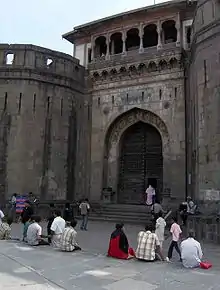
Guruwar Peth is an area located in Pune (Old) City, in Maharashtra State of the Republic of India.
The Church of the Holy Name, built in December 1885, possesses the tallest bell tower in Guruwar Peth.
Location
References
This article is issued from Wikipedia. The text is licensed under Creative Commons - Attribution - Sharealike. Additional terms may apply for the media files.
