Havelock North
Karanema | |
|---|---|
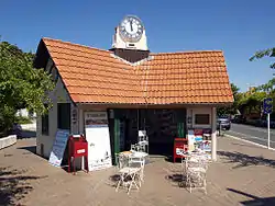
 Clock Tower Building (1914) | |
| Coordinates: 39°40′S 176°53′E / 39.667°S 176.883°E | |
| Country | New Zealand |
| Region | Hawke's Bay |
| Territorial authority | Hastings District |
| Ward |
|
| Electorates | |
| Government | |
| • Territorial Authority | Hastings District Council |
| • Regional council | Hawke's Bay Regional Council |
| Area | |
| • Total | 22.53 km2 (8.70 sq mi) |
| Population (June 2023)[2] | |
| • Total | 15,200 |
| • Density | 670/km2 (1,700/sq mi) |
| Postcode | 4130 |
| Area code | 06 |
Havelock North (Māori: Karanema)[3] is a town in the Hawke's Bay region of the North Island of New Zealand, situated less than 2 km south-east of the city of Hastings. It was a borough for many years until the 1989 reorganisation of local government saw it merged into the new Hastings District, and it is now administered by the Hastings District Council.
Overview

The suburb, known locally as "the village", is situated on the Heretaunga Plains, less than 2 km to the south-east of Hastings. It is surrounded by numerous orchards and vineyards, and its industry is based around its fruit and wine production, and a horticultural research centre. The fertile soils that lie between Havelock North and Hastings has prevented urban sprawl linking them together. Havelock North itself is primarily residential and rural-residential housing, with only a relatively small and compact industrial and commercial centre. As a result, a large majority of its 13,000 residents commute each morning to the nearby cities (Hastings or Napier) for work.
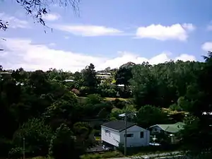
Havelock North is generally hilly, and small gullies have been formed by the creeks and streams flowing from higher ground, resulting in a small amount of inaccessible or steep land which is converted into forests, parks or reserves, giving the image of naturally having many bushes and trees. This is due to the town being situated at the base of the prominent landmark Te Mata Peak, a 399-metre outcrop, which according to local Māori legend is the body of the giant Te Mata o Rongokako,[4] and the depression in the land visible behind his head according to the myth is where he tried to bite through the mountain range which filled his stomach turning him to stone.[5]
Both Hastings and Havelock North obtain water from secure confined aquifer systems. The Te Mata aquifer that feeds Havelock North is very similar to Hastings in quality, but has slightly elevated calcium levels. Hastings is situated directly over the Heretaunga Plains aquifer system.[6][7]
History


Havelock North was founded as a planned Government settlement following the purchase in 1858, from Māori owners, of land previously known as 'Karanema's Reserve'. The original village was laid out in 1860, taking its name from Sir Henry Havelock, who was involved in the suppression of the Indian Uprising, thus keeping with the local habit of naming towns after prominent men from Imperial India. Its founders originally envisaged a larger town for the site, but when the Wellington–Napier rail line went through the area in 1874 it took a direct route some distance from Havelock North, and Hastings became a more logical choice for residents.
In the early 1800s, the local Karamu Stream was part of the much larger Ngaruroro River system. It was termed the "River Plassey", the same name also being applied to a street in the village after the battle of Plassey of 1757 near Calcutta. Early survey plans of Havelock North show ferry landings where boats would sail up and down the river to collect and deliver supplies. This practice was phased out in the 1880s, when a number of large floods diverted the Ngaruroro River to its current course further north away from Havelock North. Later, during the 1931 earthquake, a bridge over the Karamu was completely destroyed.
Like a number of North Island towns, Havelock North has grown larger than its South Island namesake, Havelock, in the Marlborough Sounds.
Havelock North was the centre for Havelock Work, a quasi-religious movement based at a temple of the Stella Matutina magical order, which followed the early twentieth century teachings of the Hermetic Order of the Golden Dawn. The building housing the temple survives today as Whare Ra.
From 12 to 29 August 2016 the town experienced New Zealand's largest recorded outbreak of waterborne disease. Campylobacter entered the town's water supply after run off from a nearby sheep farm entered the Brookvale boreholes following heavy rain. Of the town's 13,000 residents, 5,500 fell ill, 45 were hospitalised and four died.[8]
Demographics
Havelock North covers 22.53 km2 (8.70 sq mi)[1] and had an estimated population of 15,200 as of June 2023,[2] with a population density of 675 people per km2.
| Year | Pop. | ±% p.a. |
|---|---|---|
| 2001 | 10,392 | — |
| 2006 | 12,222 | +3.30% |
| 2013 | 13,167 | +1.07% |
| 2018 | 14,331 | +1.71% |
| The 2001 population may not use the same boundaries Source: [9][10] | ||
Havelock North had a population of 14,331 at the 2018 New Zealand census, an increase of 1,164 people (8.8%) since the 2013 census, and an increase of 2,109 people (17.3%) since the 2006 census. There were 5,505 households, comprising 6,564 males and 7,770 females, giving a sex ratio of 0.84 males per female, with 2,763 people (19.3%) aged under 15 years, 1,791 (12.5%) aged 15 to 29, 5,943 (41.5%) aged 30 to 64, and 3,840 (26.8%) aged 65 or older.
Ethnicities were 91.0% European/Pākehā, 10.0% Māori, 1.3% Pacific peoples, 3.5% Asian, and 2.1% other ethnicities. People may identify with more than one ethnicity.
The percentage of people born overseas was 20.8, compared with 27.1% nationally.
Although some people chose not to answer the census's question about religious affiliation, 46.5% had no religion, 43.5% were Christian, 0.6% had Māori religious beliefs, 0.5% were Hindu, 0.5% were Muslim, 0.5% were Buddhist and 1.7% had other religions.
Of those at least 15 years old, 3,228 (27.9%) people had a bachelor's or higher degree, and 1,626 (14.1%) people had no formal qualifications. 2,523 people (21.8%) earned over $70,000 compared to 17.2% nationally. The employment status of those at least 15 was that 5,097 (44.1%) people were employed full-time, 1,812 (15.7%) were part-time, and 225 (1.9%) were unemployed.[9]
| Name | Area (km2) | Population | Density (per km2) | Households | Median age | Median income |
|---|---|---|---|---|---|---|
| Lucknow | 0.58 | 1,461 | 2,519 | 480 | 31.5 years | $26,800[11] |
| Karanema-St Hill | 0.95 | 1,950 | 2,053 | 741 | 57.4 years | $25,400[12] |
| Havelock North-Central | 0.47 | 441 | 938 | 216 | 55.4 years | $32,700[13] |
| Brookvale | 1.74 | 2,433 | 1,398 | 972 | 51.0 years | $34,900[14] |
| Iona | 1.47 | 2,667 | 1,814 | 978 | 44.0 years | $33,000[15] |
| Hereworth | 1.62 | 2,865 | 1,769 | 1,143 | 47.7 years | $38,100[16] |
| Te Mata Hills | 12.71 | 984 | 77 | 357 | 48.8 years | $53,900[17] |
| Havelock Hills | 2.99 | 1,530 | 512 | 618 | 50.0 years | $42,600[18] |
| New Zealand | 37.4 years | $31,800 |
Education

Havelock North has eight schools:[19]
- Havelock North Primary School is a state contributing primary (Year 1–6) school with approximately 512 students.
- Lucknow School is a state contributing primary (Year 1–6) school with approximately 308 students.
- Te Mata School is a state contributing primary (Year 1–6) school with approximately 533 students.
- Hereworth School is a private full primary (Year 1–8) school with approximately 265 students.
- Havelock North Intermediate is a state intermediate (Year 7–8) school with approximately 516 students.
- Havelock North High School is a state secondary (Year 9–13) school with approximately 1116 students. The school opened in 1975.
- Iona College is a state-integrated Presbyterian girls' secondary school (Year 7–13) with approximately 316 students. The school opened in 1914.
- Woodford House is a state-integrated Anglican girls' secondary (Year 7–13) school with approximately 359 students. It was established by Annie Mabel Hodge in 1894.[20] When she retired in 1922, she was succeeded by Dorice Mary Holland.[21]
Hereworth, Iona College and Woodford House are boarding schools.[19] They take a very few local day pupils.[22]
Residents
Notable residents have included:
- Mac Cooper (1910–1989), agriculturalist and author
- Alan Duff (born 1950), novelist
- Dr Robert William Felkin (1853–1926), medical missionary, ceremonial magician, author on Uganda and Central Africa, explorer, and early anthropologist
- Neil Gaiman (born 1960), author[23]
- Virginia Heath (born 1959), film director and academic
- Amy Hodgson(1888–1983), botanist
- Alfred Meebold (1863–1952), botanist, writer, and anthroposopher (died at Havelock North)
- Amanda Palmer (born 1976), musician[24]
- Jarrod Smith (born 1984), footballer
- Ashley Stichbury (1971–2002), racing driver
- Herbert Sutcliffe (1878–1971), health advocate
- Ihaia West (born 1992), rugby union player
References
- 1 2 "ArcGIS Web Application". statsnz.maps.arcgis.com. Retrieved 12 February 2023.
- 1 2 "Subnational population estimates (RC, SA2), by age and sex, at 30 June 1996-2023 (2023 boundaries)". Statistics New Zealand. Retrieved 25 October 2023. (regional councils); "Subnational population estimates (TA, SA2), by age and sex, at 30 June 1996-2023 (2023 boundaries)". Statistics New Zealand. Retrieved 25 October 2023. (territorial authorities); "Subnational population estimates (urban rural), by age and sex, at 30 June 1996-2023 (2023 boundaries)". Statistics New Zealand. Retrieved 25 October 2023. (urban areas)
- ↑ "New signs for Heretaunga/Hastings use both Māori and English". Te Ao Māori News. 21 May 2023.
- ↑ Te Ahukaramū Charles Royal. 'Papatūānuku – the land – Stories of people and land', Te Ara – the Encyclopedia of New Zealand, updated 8-Jul-13
- ↑ sleeping giant
- ↑ Heretaunga Plains Groundwater Study, Exec Summary
- ↑ Heretaunga Plains Groundwater Study, Volume 1 Archived 13 December 2014 at the Wayback Machine
- ↑ "The Economic Costs of the Havelock North August 2016 Waterborne Disease Outbreak" (PDF). Ministry of Health. 25 September 2017. Retrieved 3 October 2018.
- 1 2 "Statistical area 1 dataset for 2018 Census". Statistics New Zealand. March 2020. Lucknow (211400), Karanema-St Hill (211500), Havelock North-Central (211600), Brookvale (211700), Iona (211800), Hereworth (211900), Te Mata Hills (212000) and Havelock Hills (212100).
- ↑ "Infoshare; Group: Population Estimates – DPE; Table: Estimated Resident Population for Urban Areas, at 30 June (1991+) (Annual-Jun)". Statistics New Zealand. Retrieved 17 June 2015.
- ↑ 2018 Census place summary: Lucknow
- ↑ 2018 Census place summary: Karanema-St Hill
- ↑ 2018 Census place summary: Havelock North-Central
- ↑ 2018 Census place summary: Brookvale
- ↑ 2018 Census place summary: Iona
- ↑ 2018 Census place summary: Hereworth
- ↑ 2018 Census place summary: Te Mata Hills
- ↑ 2018 Census place summary: Havelock Hills
- 1 2 "New Zealand Schools Directory". New Zealand Ministry of Education. Retrieved 12 December 2022.
- ↑ New Zealand Ministry for Culture and Heritage Te Manatu Taonga. "Hodge, Annie Mabel". teara.govt.nz. Retrieved 2 June 2021.
- ↑ Varnham, Mary. Beyond Blue Hills: One Hundred Years of Woodford House, 1994
- ↑ Varnham, Mary. Beyond Blue Hills: One Hundred Years of Woodford House, 1994
- ↑ Sowman-Lund, Stewart (31 August 2020). "Amanda Palmer isn't going anywhere". The Spinoff. Retrieved 14 January 2021.
- ↑ Sowman-Lund, Stewart (31 August 2020). "Amanda Palmer isn't going anywhere". The Spinoff. Retrieved 5 October 2020.