Hemmingford | |
|---|---|
_Quebec_location_diagram.PNG.webp) Location within Les Jardins-de-Napierville RCM. | |
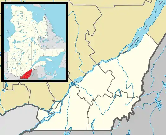
 Hemmingford Location in southern Quebec. | |
| Coordinates: 45°03′N 73°35′W / 45.050°N 73.583°W[1] | |
| Country | |
| Province | |
| Region | Montérégie |
| RCM | Les Jardins-de-Napierville |
| Constituted | January 1, 1878 |
| Government | |
| • Mayor | Drew Somerville |
| • Federal riding | Beauharnois—Salaberry |
| • Prov. riding | Huntingdon |
| Area | |
| • Total | 0.91 km2 (0.35 sq mi) |
| • Land | 1.07 km2 (0.41 sq mi) |
| There is an apparent contradiction between two authoritative sources | |
| Population (2021)[4] | |
| • Total | 829 |
| • Density | 775.6/km2 (2,009/sq mi) |
| • Pop 2016-2021 | |
| • Dwellings | 403 |
| Time zone | UTC−5 (EST) |
| • Summer (DST) | UTC−4 (EDT) |
| Postal code(s) | |
| Area code(s) | 450 and 579 |
| Highways | |
| Census profile | 2468010[5] |
| MAMROT info | 68010[6] |
| Toponymie info | 28437[1] |
| Website | www |
Hemmingford is a village municipality located in Les Jardins-de-Napierville Regional County Municipality of southern Quebec. The population as of 2021 was 829.
It was founded in 1878 by the division of the Township of Hemmingford creating two separate entities: the Township and the Village of Hemmingford. Both municipalities are locally referred to collectively as Hemmingford. The two share many things, such as the cost of the volunteer fire department and both hold their councils and offices in the same building in the village.
The village of Hemmingford is surrounded by the Township of Hemmingford. The centre of the village is at the intersection of Route 219 and Route 202.
The postal code for both the town and village of Hemmingford is J0L 1H0.
Demographics
| Year | Pop. | ±% |
|---|---|---|
| 1991 | 729 | — |
| 1996 | 751 | +3.0% |
| 2001 | 724 | −3.6% |
| 2006 | 757 | +4.6% |
| 2011 | 808 | +6.7% |
| 2016 | 755 | −6.6% |
| 2021 | 829 | +9.8% |
In the 2021 Census of Population conducted by Statistics Canada, Hemmingford had a population of 829 living in 379 of its 403 total private dwellings, a change of 9.8% from its 2016 population of 755. With a land area of 1.07 km2 (0.41 sq mi), it had a population density of 774.8/km2 (2,006.6/sq mi) in 2021.[8]
| 2021 | 2016 | 2011 | |
|---|---|---|---|
| Population | 829 (+9.8% from 2016) | 755 (-6.6% from 2011) | 808 (+6.7% from 2006) |
| Land area | 1.07 km2 (0.41 sq mi) | 0.91 km2 (0.35 sq mi) | 1.03 km2 (0.40 sq mi) |
| Population density | 775.6/km2 (2,009/sq mi) | 826.7/km2 (2,141/sq mi) | 783.2/km2 (2,028/sq mi) |
| Median age | 44.8 (M: 43.6, F: 46.4) | 45.1 (M: 45.9, F: 43.7) | 44.8 (M: 44.4, F: 45.0) |
| Private dwellings | 403 (total) 379 (occupied) | 350 (total) | 383 (total) |
| Median household income | $61,200 | $47,360 | $44,042 |
| Canada Census Mother Tongue - Hemmingford (village), Quebec[7] | ||||||||||||||||||
|---|---|---|---|---|---|---|---|---|---|---|---|---|---|---|---|---|---|---|
| Census | Total | French |
English |
French & English |
Other | |||||||||||||
| Year | Responses | Count | Trend | Pop % | Count | Trend | Pop % | Count | Trend | Pop % | Count | Trend | Pop % | |||||
2011 |
810 |
355 | 43.83% | 395 | 48.76% | 20 | 2.47% | 40 | 4.94% | |||||||||
2006 |
755 |
380 | 50.33% | 315 | 41.72% | 20 | 2.65% | 40 | 5.30% | |||||||||
2001 |
715 |
335 | 46.85% | 345 | 48.25% | 0 | 0.00% | 35 | 4.90% | |||||||||
1996 |
745 |
450 | n/a | 60.40% | 285 | n/a | 38.26% | 10 | n/a | 1.34% | 0 | n/a | 0.00% | |||||
See also
References
- 1 2 "Banque de noms de lieux du Québec: Reference number 28437". toponymie.gouv.qc.ca (in French). Commission de toponymie du Québec.
- 1 2 Ministère des Affaires municipales, des Régions et de l'Occupation du territoire: Hemmingford (village)
- ↑ Riding history for Beauharnois—Salaberry, Quebec from the Library of Parliament
- 1 2 2021 Statistics Canada Census Profile: Hemmingford, Village, Quebec
- ↑ "Hemmingford, Quebec (village) (Code 2468010) Census Profile". 2011 census. Government of Canada - Statistics Canada.
- ↑ "Répertoire des municipalités: Geographic code 68010". www.mamh.gouv.qc.ca (in French). Ministère des Affaires municipales et de l'Habitation.
- 1 2 Statistics Canada: 1996, 2001, 2006, 2011, 2016, 2021 census
- ↑ "Population and dwelling counts: Canada, provinces and territories, and census subdivisions (municipalities), Quebec". Statistics Canada. February 9, 2022. Retrieved August 28, 2022.
- ↑ "2021 Community Profiles". 2021 Canadian Census. Statistics Canada. February 4, 2022. Retrieved 2023-10-19.
- ↑ "2016 Community Profiles". 2016 Canadian Census. Statistics Canada. August 12, 2021. Retrieved 2018-04-22.
- ↑ "2011 Community Profiles". 2011 Canadian Census. Statistics Canada. March 21, 2019. Retrieved 2014-03-01.
- ↑ "2006 Community Profiles". 2006 Canadian Census. Statistics Canada. August 20, 2019.
- ↑ "2001 Community Profiles". 2001 Canadian Census. Statistics Canada. July 18, 2021.
External links
- Hemmingford Village and Township website
- The Gleaner/La Source (local English/French newspaper)
- Statistics Canada 2011 census results for Hemmingford (village)
- Epodunk Canada search results for Hemmingford
- Google map of the village of Hemmingford