| Hirose-taisha 廣瀬大社 | |
|---|---|
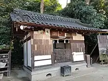
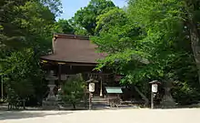 Haiden, or the prayer hall | |
| Religion | |
| Affiliation | Shinto |
| Deity |
|
| Festival |
|
| Location | |
| Location | 99 Kawai, Kawai-cho, Kitakatsuragi-gun, Nara Prefecture, Japan |
 Shown within Japan | |
| Geographic coordinates | 34°35′30″N 135°44′54″E / 34.59167°N 135.74833°E |
| Architecture | |
| Style | Kasuga-zukuri |
| Founder |
|
| Date established |
|
| Website | |
| www | |
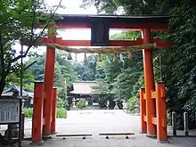
The second torii at Hirose Shrine.
The haiden at Hirose Shrine.
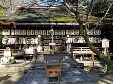
Shinme-sha (sacred horse house) at Hirose Shrine.
Hirose Shrine (廣瀬大社, Hirose-taisha), also referred to as Hirose-jinja, is a Shinto shrine located in Kawai, Nara prefecture, Japan.
The shrine became the object of Imperial patronage during the early Heian period.[1] In 965, Emperor Murakami ordered that Imperial messengers were sent to report important events to the guardian kami of Japan. These heihaku were initially presented to 16 shrines including the Hirose Shrine.[2]
From 1871 through 1946, Hirose Shrine was officially designated one of the kanpei-taisha (官幣大社), meaning that it stood in the first rank of government supported shrines.[3]
See also
Notes
- ↑ Breen, John et al. (2000). Shinto in History: Ways of the Kami, pp. 74-75.
- ↑ Ponsonby-Fane, Richard. (1962). Studies in Shinto and Shrines, pp. 116-117.
- ↑ Ponsonby-Fane, Richard. (1959). The Imperial House of Japan, pp. 124.
External links
- Official website (in Japanese)
References
- Breen, John and Mark Teeuwen. (2000). Shinto in History: Ways of the Kami. Honolulu: University of Hawaii Press. ISBN 978-0-8248-2363-4
- Ponsonby-Fane, Richard. (1962). Studies in Shinto and Shrines. Kyoto: Ponsonby Memorial Society. OCLC 399449
- _______. (1959). The Imperial House of Japan. Kyoto: Ponsonby Memorial Society. OCLC 194887
34°35′30″N 135°44′54″E / 34.59167°N 135.74833°E
This article is issued from Wikipedia. The text is licensed under Creative Commons - Attribution - Sharealike. Additional terms may apply for the media files.