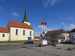
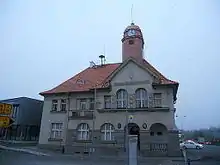
Holýšov | |
|---|---|
 Town square | |
 Flag  Coat of arms | |
 Holýšov Location in the Czech Republic | |
| Coordinates: 49°35′34″N 13°5′50″E / 49.59278°N 13.09722°E | |
| Country | |
| Region | Plzeň |
| District | Plzeň-South |
| First mentioned | 1273 |
| Government | |
| • Mayor | Alena Burianová |
| Area | |
| • Total | 29.32 km2 (11.32 sq mi) |
| Elevation | 357 m (1,171 ft) |
| Population (2023-01-01)[1] | |
| • Total | 5,489 |
| • Density | 190/km2 (480/sq mi) |
| Time zone | UTC+1 (CET) |
| • Summer (DST) | UTC+2 (CEST) |
| Postal code | 345 62 |
| Website | www |
Holýšov (Czech pronunciation: [ˈɦoliːʃof]; German: Holleischen) is a town in Plzeň-South District in the Plzeň Region of the Czech Republic. It has about 5,500 inhabitants.
Administrative parts

The village of Dolní Kamenice is an administrative part of Holýšov.
Geography
Holýšov is located about 25 km (16 mi) southwest of Plzeň. It lies mostly in the Švihov Highlands, only the western part of the municipal territory lies in the Plasy Uplands. The highest point is a hill with an altitude of 516 m (1,693 ft). The town is situated on the right bank of the Radbuza River.
History
The first written mention of Holýšov is in a deed of Pope Gregory X from 1273. Transformation from a small village to a town began after 1897, when one of the biggest glassworks in Austria-Hungary were founded and the population significantly increased. The glassworks went bankrupt due to the world crisis in the 1930s.[2]
During World War II, Holýšov was occupied by Germany. The glassworks building was rebuilt to an ammunition factory.[2] In 1944, two subcamps of the Flossenbürg concentration camp were founded: one for French, Polish, Russian and Jewish women, and one for Polish, Jewish, Czech and Russian men.[3] The men's subcamp was presumably dissolved in January 1945, whereas the women's subcamp was liberated by Polish partisans in May 1945.[3] After the German occupation, the town was restored to Czechoslovakia.
In 1960, Holýšov obtained the town status.[2] From 1 January 2021, Holýšov is no longer a part of Domažlice District and belongs to Plzeň-South District.[4]
Demographics
|
|
| ||||||||||||||||||||||||||||||||||||||||||||||||||||||
| Source: Censuses[5][6] | ||||||||||||||||||||||||||||||||||||||||||||||||||||||||
Transport

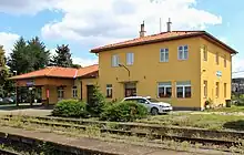
Holýšov is located on the international railway line Prague–Plzeň–Munich.
Sights
_(5).jpg.webp)
The oldest building in Holýšov is the Church of Saints Peter and Paul. It was first mentioned in 1352 and in 1384, it was referred to as a parish church. During the Thirty Years' War, it was partly demolished. It was completely rebuilt in the Baroque style in 1743 and a three-story tower was also built, which is 39 39 m (128 ft) tall and topped with a tall slender spire.[7]
Exposition dedicated to the history of Holýšov and the history of World War II in Holýšov are in the town museum named Dům dějin Holýšovska ("House of history of the Holýšov region").[8]
Twin towns – sister cities
 Kümmersbruck, Germany
.svg.png.webp) Port, Switzerland
Port, Switzerland
References
- ↑ "Population of Municipalities – 1 January 2023". Czech Statistical Office. 2023-05-23.
- 1 2 3 "Historie města" (in Czech). Město Holýšov. Retrieved 2022-11-26.
- 1 2 "Holleischen (Holýšov) Subcamp". KZ-Gedenkstätte Flossenbürg. Retrieved 2022-08-21.
- ↑ "Obecně o novém zákonu č. 51/2020 Sb" (in Czech). Ministry of the Interior of the Czech Republic. Retrieved 2021-05-24.
- ↑ "Historický lexikon obcí České republiky 1869–2011 – Okres Domažlice" (in Czech). Czech Statistical Office. 2015-12-21. pp. 3–4.
- ↑ "Population Census 2021: Population by sex". Public Database. Czech Statistical Office. 2021-03-27.
- ↑ "Kostel sv. Petra a Pavla" (in Czech). Město Holýšov. Retrieved 2022-11-26.
- ↑ "O nás" (in Czech). Dům dějin Holýšovska. Retrieved 2022-11-26.
- ↑ "Partnerské obce" (in Czech). Město Holýšov. Retrieved 2020-08-04.