Mb03 Hōnanchō Station 方南町駅 | |||||||||||
|---|---|---|---|---|---|---|---|---|---|---|---|
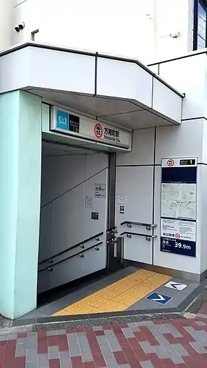
 No. 1 entrance in February 2022 | |||||||||||
| General information | |||||||||||
| Location | 1-1-1 Horinouchi, Suginami City, Tokyo 166-0013 Japan | ||||||||||
| Operated by | |||||||||||
| Line(s) | Mb Marunouchi Line – (Branch line) | ||||||||||
| Platforms | 1 island platform | ||||||||||
| Tracks | 2 | ||||||||||
| Connections | |||||||||||
| Construction | |||||||||||
| Structure type | Underground | ||||||||||
| Other information | |||||||||||
| Station code | Mb-03 | ||||||||||
| Website | Official website | ||||||||||
| History | |||||||||||
| Opened | 23 March 1962 | ||||||||||
| Passengers | |||||||||||
| FY2013 | 33,335 daily | ||||||||||
| Services | |||||||||||
| |||||||||||
| Location | |||||||||||
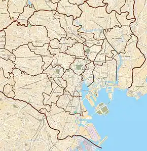
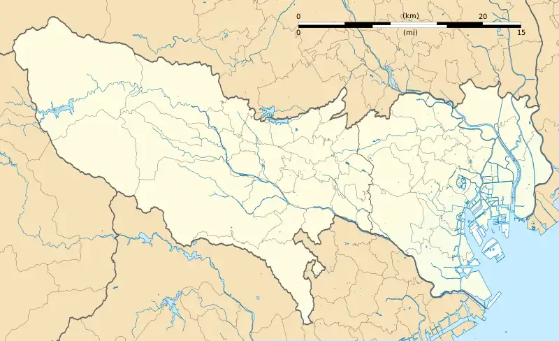
 Honancho Station Location within Special wards of Tokyo  Honancho Station Honancho Station (Tokyo Bay and Bōsō Peninsula)  Honancho Station Honancho Station (Tokyo)  Honancho Station Honancho Station (Japan) | |||||||||||
Hōnanchō Station (方南町駅, Hōnanchō-eki) is a subway station on the Tokyo Metro Marunouchi Line in Suginami, Tokyo, Japan, operated by the Tokyo subway operator Tokyo Metro.
Lines
Hōnanchō Station is the terminus of the 3.2 km (2.0 mi) Honancho branch of the Tokyo Metro Marunouchi Line from Nakano-sakaue.[1] It is numbered "Mb-03".
Station layout
The station consists of a single underground island platform on the second basement level, serving two tracks.[1]
There are two entrances to the station: Entrance 1 provides access to the west (terminating) end of the platforms via a concourse on the same second basement level, while Entrance 2 provides access to the east end of the platforms via a concourse on the first basement level. Toilet facilities are available on the Entrance 1 concourse.[2]
Platforms
| 1/2 | Mb Marunouchi Line (Hōnanchō Branch) | for Ikebukuro |
 No. 2 entrance in April 2011
 Ticket gates at the west end of the platforms in December 2006
 The west end of the platforms in November 2013
 The east end of the platforms in November 2013
History
Honancho Station opened on 23 March 1962.[3]
The station facilities were inherited by Tokyo Metro after the privatization of the Teito Rapid Transit Authority (TRTA) in 2004.[4]
Construction work started in 2013 to extend the platform-edge doors along the platforms to handle six-car trains, allowing through-running services to and from Ikebukuro via the main Marunouchi Line from fiscal 2017.[5]
Passenger statistics
In fiscal 2013, the station was the hundredth-busiest on the Tokyo Metro network with an average of 33,335 passengers daily.[6]
The passenger statistics for previous years are as shown below.
| Fiscal year | Daily average |
|---|---|
| 2011 | 31,095[3][7] |
| 2012 | 32,060[8] |
| 2013 | 33,335[6] |
Surrounding area
Exit 1 (west end)
- Izumi Health Center
- Sennan Junior High School
Exit 2 (east end)
- Nakano Special Needs Education School
- Minami-Nakano Junior High School
- Honan Elementary School
See also
References
- 1 2 Kawashima, Ryozo (April 2010). 日本の鉄道 中部ライン 全線・全駅・全配線 第1巻 東京駅―三鷹エリア [Railways of Japan - Chubu Line - Lines/Stations/Track plans - Vol 1 Tokyo Station - Mitaka Area]. Japan: Kodansha. p. 79. ISBN 978-4-06-270061-0.
- ↑ 方南町駅 構内図 [Honancho Station map] (in Japanese). Japan: Tokyo Metro. 30 April 2013. Retrieved 14 November 2013.
- 1 2 Terada, Hirokazu (19 January 2013). データブック日本の私鉄 [Databook: Japan's Private Railways]. Japan: Neko Publishing. p. 215. ISBN 978-4-7770-1336-4.
- ↑ "「営団地下鉄」から「東京メトロ」へ" [From "Teito Rapid Transit Authority" to "Tokyo Metro"]. Tokyo Metro Online. 8 July 2006. Archived from the original on 16 May 2012. Retrieved 29 May 2022.
- ↑ 丸ノ内線、方南町駅へ直通運転開始 東京メトロが17年度から [Tokyo Metro to operate through trains on Marunouchi Line to Hōnanchō Station from fiscal 2017]. Nikkei Shimbun (in Japanese). Japan: Nikkei Inc. 13 November 2013. Retrieved 14 November 2013.
- 1 2 各駅の乗降人員ランキング [Station usage ranking] (in Japanese). Tokyo Metro. Retrieved 9 September 2014.
- ↑ 駅別乗降人員順位表(2011年度1日平均) [Station passenger figures (Fiscal 2011)] (in Japanese). Japan: Tokyo Metro. Retrieved 9 September 2014.
- ↑ 各駅の乗降人員ランキング (2012年) [Station usage ranking (2012)] (in Japanese). Tokyo Metro. Retrieved 9 September 2014.
External links
- Tokyo Metro station information (in Japanese)