| Ichvuveyem | |
|---|---|
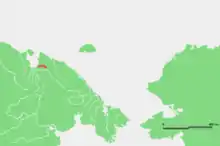
 Location of the Ichvuveyem course | |
| Location | |
| Country | Russia |
| Physical characteristics | |
| Mouth | East Siberian Sea |
• coordinates | 69°02′47″N 171°00′39″E / 69.0464°N 171.0108°E |
| Length | 154 km (96 mi) |
| Basin size | 2,960 km2 (1,140 sq mi) |
The Ichvuveyem (Russian: Ичвувеем,[1] also: Ичувеем Ichuveyem) is a stream in Far East Siberia flowing in a roughly westward direction. Its valley marks the southern limit of the Shelag Range. The Ichvuveyem is 154 kilometres (96 mi) long, and has a drainage basin of 2,960 square kilometres (1,140 sq mi).[2] It passes through the sparsely populated areas of the Siberian tundra and flows into the East Siberian Sea at the Chaunskaya Bay. Its mouth is in a low, marshy area to the NE of the mouth of the Chaun.
The Ichvuveyem and its basin belong to the Chukotka Autonomous Okrug administrative region of Russia.
References
- ↑ Словарь названий гидрографических объектов России и других стран — членов СНГ Archived 2016-03-06 at the Wayback Machine, Federal Service for Geodesy and Cartography of Russia, 1999, p. 152
- ↑ "Река Ичувеем in the State Water Register of Russia". textual.ru (in Russian).
External links
- http://worldmaps.web.infoseek.co.jp/russia_guide.htm
- Location
- Tourism and environment Archived 2010-09-01 at the Wayback Machine
This article is issued from Wikipedia. The text is licensed under Creative Commons - Attribution - Sharealike. Additional terms may apply for the media files.