U.S. Route 34 | ||||
|---|---|---|---|---|
| Walter Payton Memorial Highway[1] Ogden Avenue | ||||
US 34 highlighted in red | ||||
| Route information | ||||
| Maintained by IDOT | ||||
| Length | 211.37 mi[2] (340.17 km) | |||
| Existed | 1926–present | |||
| Major junctions | ||||
| West end | ||||
| ||||
| East end | ||||
| Location | ||||
| Country | United States | |||
| State | Illinois | |||
| Counties | Henderson, Warren, Knox, Henry, Bureau, LaSalle, DeKalb, Kendall, Kane, DuPage, Cook | |||
| Highway system | ||||
| ||||
| ||||

U.S. Route 34 (US 34) is an east–west highway In the state of Illinois that runs from the Iowa state line at Gulfport, west of Galesburg, to Illinois Route 43 (IL 43) and Historic U.S. Route 66 at Harlem Avenue in Berwyn. The entire highway in Illinois is named the Walter Payton Memorial Highway after Pro Football Hall of Famer Walter Payton, who wore #34 for the Chicago Bears. The highway is 211.37 miles (340.17 km) long within the state.[2]
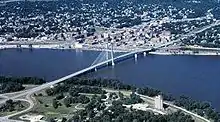
The bridge into Iowa over the Mississippi River is called the Great River Bridge. Between Monmouth and Galesburg, the highway is up to Interstate Highway standards with exits at Main Street, Henderson Street, and Seminary Street in Galesburg.
Route description
Iowa state line to Monmouth
After leaving Iowa via the Great River Bridge, US 34 enters Gulfport. In Gulfport, US 34 meets a local road at a parclo. It then travels further east, then turns into a 2-lane undivided highway, then turns northeast, and then back east again. It then meets IL 164 south of Gladstone. Just west of Biggsville, US 34 turns into a 4-lane divided bypass. After that, US 34 meets IL 94 and IL 116. East of Biggsville, it soon reverts to a 2-lane highway again. At Kirkwood, it turns north and then east again. At a 5-ramp parclo, US 34 turns north onto a 4-lane divided expressway (signed as US 67/IL 110 (CKC)). Just west of Monmouth, IL 164 runs concurrently with the other two routes. After they curve east, US 67 branches off north from the other three routes. Just northeast of Monmouth, IL 164 branches off northeast. The other two routes then become a freeway.[3]
Monmouth to Kewanee
In the middle of Coldbrook and Cameron, the two routes meet a local road at a diamond interchange. Northeast of the Galesburg Municipal Airport, they then meet IL 164 (once again) and IL 41 at another diamond interchange where both IL 164 and IL 41 end. They then meet US 150 at a cloverleaf interchange and then another local road at a diamond interchange. At another cloverleaf interchange, IL 110 diverges north via I-74 while US 34 moves eastward (soon northeastward). At that point, the freeway ends and becomes a 2-lane road. North of Wataga, IL 167 intersects and ends at US 34. It continues northeasterly until it reaches Altona. At that point, it travels due north and then curves east. At that curve, it then runs concurrently with IL 17. IL 17 then diverges southward in Galva. US 34 then turns northeast, begins to run concurrently with IL 78, turn north, and intersect IL 91 before reaching Kewanee.[3]
Kewanee to Berwyn
At 2nd Street in Kewanee, US 34 turns east from IL 78. Then, it turns north before reaching a railroad. At that point, it turns northeast which follows the railroad. Northeast of Neponset, it turns northward. Between Sheffield and Princeton, US 34 runs concurrently with US 6. In Princeton, it then follows IL 26 before it reaches Elm Place where US 34 branches off east (soon northeast). It then crosses under I-80, intersects IL 89, and then IL 92 in LaMoille. At the junction where US 34 intersect IL 92, it turns east. Further east, it intersects US 52/IL 251 in Mendota, then turns north, northeast, then turns back east, and then meets I-39/US 51 east of Mendota. The route continues east, swinging north and east twice before running along the southern border of Earlville and meeting IL 23 South of Leland. IL 23 runs concurrently with US 34 for about 4 miles. Then, between Leland and Somonauk, IL 23 branches off northward. Continuing east, it intersects IL 47 in Yorkville, IL 31, IL 25, and IL 71 in Oswego. Furthermore, it briefly runs concurrently with US 30 southeast of Aurora, intersects IL 59 at the city limit of Naperville, and meets IL 53 in Lisle at a 4-ramp parclo. Near the Illinois Tollway headquarters, it meets I-355, as well as I-88, at a mix of interchanges. Further east, it meets IL 83 at another 4-ramp parclo, I-294 at a cloverleaf interchange, intersects US 12/US 20/US 45 north of La Grange, and then IL 171 in Lyons before US 34 ends at IL 43 at Berwyn. At that point, the road continues on as Ogden Avenue and Historic US 66 all the way to Chicago.[3]
History
Up until 1935, Illinois Route 28 roughly followed US 34 from Galesburg to Sheffield. Also, a part of IL 8 followed part of US 34 from Burlington to Galesburg.[4] In 1935, US 34 absorbed what had been the last remaining section of US 32 as well as IL 18, IL 28, and a portion of IL 8.[5][6]
US 34 formerly overlapped US 66 all the way to its endpoint in downtown Chicago, but was truncated to its intersection with US 66 and IL 43 in Berwyn in 1970.[7] When US 66 was subsequently eliminated, the endpoint of US 34 was left at that location—the intersection of Ogden and Harlem Avenues in Berwyn. Due to the elimination of US 66, it is one of the few U.S. Highways that ends at a state highway.[8] With the re-signing of much of Historic US 66, the history of US 34's eastern endpoint is becoming much more clear.[9]
Major intersections
All exits are unnumbered.
| County | Location | mi[3] | km | Destinations | Notes | |||
|---|---|---|---|---|---|---|---|---|
| Mississippi River | 0.00 | 0.00 | Continuation into Iowa | |||||
| Great River Bridge | ||||||||
| Henderson | Gulfport | 0.6 | 0.97 | Gulfport | ||||
| | 2.2 | 3.5 | West end of Great River Road overlap; east end of freeway section | |||||
| Gladstone | 8.4 | 13.5 | East end of Great River Road overlap | |||||
| Biggsville | 11.5 | 18.5 | Interchange Completed in 2014 | |||||
| Warren | | 25.9 | 41.7 | West end of US 67/IL 110 overlap; interchange | ||||
| Monmouth | 27.8 | 44.7 | West end of IL 164 overlap | |||||
| 29.3 | 47.2 | East end of US 67 overlap | ||||||
| | 31.4 | 50.5 | East end of IL 164 overlap | |||||
| | 36.2 | 58.3 | Cameron Road | West end of freeway section | ||||
| Knox | Galesburg | 42.9 | 69.0 | |||||
| 45.7 | 73.5 | |||||||
| 46.8 | 75.3 | Seminary Street | ||||||
| | 48.2 | 77.6 | East end of IL 110 overlap; east end of freeway section; I-74 exit 46 | |||||
| Wataga | 53.2 | 85.6 | ||||||
| Henry | | 64.8 | 104.3 | West end of IL 17 overlap | ||||
| Galva | 70.8 | 113.9 | East end of IL 17 overlap | |||||
| | 77.0 | 123.9 | West end of IL 78 overlap | |||||
| | 77.5 | 124.7 | ||||||
| Kewanee | 82.2 | 132.3 | East end of IL 78 overlap | |||||
| Bureau | | 96.0 | 154.5 | West end of US 6 overlap | ||||
| | 99.8 | 160.6 | ||||||
| Princeton | 111.4 | 179.3 | West end of IL 26 overlap; east end of US 6 overlap | |||||
| 112.2 | 180.6 | East end of IL 26 overlap | ||||||
| La Moille | 126.7 | 203.9 | ||||||
| 127.7 | 205.5 | |||||||
| LaSalle | Mendota | 135.7 | 218.4 | |||||
| | 139.5 | 224.5 | I-39 exit 72 | |||||
| | 153.6 | 247.2 | West end of IL 23 overlap | |||||
| | 157.7 | 253.8 | East end of IL 23 overlap | |||||
| DeKalb |
No major junctions | |||||||
| Kendall | Yorkville | 174.3 | 280.5 | |||||
| Oswego | 179.3 | 288.6 | ||||||
| 179.8 | 289.4 | |||||||
| 180.4 | 290.3 | |||||||
| Montgomery | 183.7 | 295.6 | West end of US 30 overlap | |||||
| 184.1 | 296.3 | East end of US 30 overlap | ||||||
| Kane |
No major junctions | |||||||
| DuPage | Aurora–Naperville city line | 188.7 | 303.7 | |||||
| Lisle | 197.1 | 317.2 | Interchange | |||||
| Lisle–Downers Grove village line | 198.3 | 319.1 | I-355 exits 19 & 20B; I-88 exit 131 | |||||
| Westmont–Hinsdale village line | 203.9 | 328.1 | Interchange | |||||
| Cook | Western Springs | 205.7 | 331.0 | I-294 exit 27 | ||||
| La Grange | 208.0 | 334.7 | ||||||
| Lyons | 209.9 | 337.8 | ||||||
| Berwyn | 211.37 | 340.17 | National eastern terminus | |||||
| Continuation beyond IL 43 | ||||||||
1.000 mi = 1.609 km; 1.000 km = 0.621 mi
| ||||||||
References
- ↑ State of Illinois (April 15, 2000). "91st General Assembly Summary of HJR0071". Retrieved November 26, 2006.
- 1 2 Illinois Technology Transfer Center (2006). "T2 GIS Data". Retrieved November 8, 2007.
- 1 2 3 4 Google (March 16, 2017). "Overview Map of US 34" (Map). Google Maps. Google. Retrieved March 16, 2017.
- ↑ Illinois Secretary of State; Rand McNally (1934). Official Road Map Illinois (Map). [c. 1:950,000 and c. 1:1,110,000]. Springfield: Illinois Secretary of State. OCLC 183709045 – via Illinois Digital Archives.
- ↑ End of US highway 32. usends.com.
- ↑ Illinois Secretary of State; H.M. Gousha (1935). Official Road Map Illinois (Map). [c. 1:950,000 and c. 1:1,110,000]. Springfield: Illinois Secretary of State – via Illinois Digital Archives.
- ↑ Illinois Division of Highways; Rand McNally (1971). Illinois Official Highway Map (Map). [1:772,500]. Springfield: Illinois Division of Highways. Retrieved November 5, 2020 – via Illinois Digital Archives.
- ↑ End of US highway 34. usends.com.
- ↑ East end of US highway 34 in Berwyn IL. usends.com.