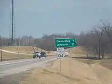
Illinois Route 104 | ||||
|---|---|---|---|---|
IL 104 highlighted in red | ||||
| Route information | ||||
| Maintained by IDOT | ||||
| Length | 125.91 mi[1] (202.63 km) | |||
| Existed | 1924[2]–present | |||
| Major junctions | ||||
| West end | ||||
| East end | ||||
| Location | ||||
| Country | United States | |||
| State | Illinois | |||
| Counties | Adams, Pike, Morgan, Sangamon, Christian | |||
| Highway system | ||||
| ||||
Illinois Route 104 is a state highway in central and western Illinois. It extends from Illinois Route 29 near Taylorville, west over the Illinois River at Meredosia to its western terminus in downtown Quincy. This is a distance of 125.91 miles (202.63 km).[1]
Route description

Illinois 104 crosses Interstate 55 at Exit 82 near Pawnee, and crosses Interstate 172 at Exit 14 near Quincy. The road also crosses Interstate 72 near Jacksonville, but there is no interchange at this crossing.
Illinois 104 doubles as the primary east–west street within the municipality of Quincy, Illinois. Called Broadway Street, the highway carries traffic up and down the Mississippi River bluffs that divide the city.
In Jacksonville, Illinois 104 intersects the new U.S. Route 67 Jacksonville Bypass and follows portions of the new Business U.S. 67 through the city. Northwest of the city, Illinois 104 and U.S. 67 are concurrent for 13 miles (21 km).
Points of interest
Points of interest along the road include:
- Illinois College, Jacksonville, Ill., one of the oldest colleges in Illinois (1829) .
- Quincy National Cemetery, Quincy, Ill. (1870); 582 interments, including 221 Union soldiers buried before 1882 .
History
Prior to 1937, Illinois 104 had run from Mount Sterling on what is now Illinois Route 99 to Taylorville on modern Illinois 104. After 1937, the route took its current routing.[3]
Major Intersections
| County | Location | mi[4] | km | Destinations | Notes |
|---|---|---|---|---|---|
| Adams | Quincy | 0.0 | 0.0 | One-way pair | |
| 0.1 | 0.16 | One-way pair | |||
| 1.8 | 2.9 | ||||
| 4.6 | 7.4 | I-172 exit 14 | |||
| Pike | | 40.1 | 64.5 | ||
| | 49.1 | 79.0 | |||
| Morgan | | 53.1 | 85.5 | West end of US 67/IL 100 concurrency | |
| | 54.0 | 86.9 | East end of IL 100 concurrency | ||
| | 66.7 | 107.3 | East end of US 67 concurrency; west end of US 67 Business concurrency | ||
| | 67.8 | 109.1 | |||
| Jacksonville | 69.9 | 112.5 | West end of I-72 Business concurrency | ||
| 72.3 | 116.4 | East end of US 67 Business concurrency | |||
| 73.7 | 118.6 | East end of I-72 Business concurrency | |||
| Waverly | 90.7 | 146.0 | |||
| Sangamon | Auburn | 101.5 | 163.3 | ||
| | 107.2 | 172.5 | |||
| 107.5 | 173.0 | I-55 exit 82, eastern end of Historic US 66 concurrency | |||
| Christian | Taylorville | 125.91 | 202.63 | ||
1.000 mi = 1.609 km; 1.000 km = 0.621 mi
| |||||
References
- 1 2 Illinois Technology Transfer Center (2006). "T2 GIS Data". Retrieved 2007-11-08.
- ↑ Carlson, Rich. Illinois Highways Page: Routes 101 thru 120. Last updated March 15, 2005. Retrieved April 28, 2006.
- ↑ Foust, Hal (March 28, 1937). "24 Highways Renumbered as Tourist Aid". The Chicago Tribune. p. 54. Retrieved December 18, 2021 – via Newspapers.com.

- ↑ Google (February 27, 2017). "Overview Map of IL 104" (Map). Google Maps. Google. Retrieved February 27, 2017.
External links
 Media related to Illinois Route 104 at Wikimedia Commons
