| Indian Creek Tributary to Youghiogheny River | |
|---|---|
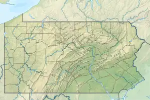 Location of Indian Creek mouth  Indian Creek (Youghiogheny River tributary) (the United States) | |
| Location | |
| Country | United States |
| State | Pennsylvania |
| County | Fayette Westmoreland |
| Physical characteristics | |
| Source | Shafer Run and Loyalhanna Creek divide |
| • location | about 5 miles southeast of Kregar, Pennsylvania[1] |
| • coordinates | 40°06′24″N 079°13′38″W / 40.10667°N 79.22722°W[2] |
| • elevation | 2,560 ft (780 m)[1] |
| Mouth | Youghiogheny River |
• location | Indian Creek, Pennsylvania[1] |
• coordinates | 39°58′05″N 079°30′46″W / 39.96806°N 79.51278°W[2] |
• elevation | 945 ft (288 m)[2] |
| Length | 29.55 mi (47.56 km)[3] |
| Basin size | 124.88 square miles (323.4 km2)[4] |
| Discharge | |
| • location | Youghiogheny River |
| • average | 228.94 cu ft/s (6.483 m3/s) at mouth with Youghiogheny River[4] |
| Basin features | |
| Progression | generally southwest |
| River system | Monongahela River |
| Tributaries | |
| • left | Little Run Camp Run Roaring Run Back Creek Laurel Run Mill Run |
| • right | Champion Creek Wash Run Poplar Run Rasler Run Richter Run Tates Run |
| Waterbodies | Mill Run Reservoir |
Indian Creek is a 31.0-mile-long (49.9 km)[5] tributary of the Youghiogheny River in Fayette County, Pennsylvania in the United States.[6][7]
Indian Creek drains the west slope of Laurel Hill in the Laurel Highlands and cuts a steep side canyon into the Youghiogheny Gorge to join the Youghiogheny River between Ohiopyle and Connellsville.[7]
See also
References
- 1 2 3 "Indian Creek Topo Map, Fayette County PA (South Connellsville Area)". TopoZone. Locality, LLC. Retrieved 30 December 2019.
- 1 2 3 "GNIS Detail - Indian Creek". geonames.usgs.gov. US Geological Survey. Retrieved 30 December 2019.
- ↑ "ArcGIS Web Application". epa.maps.arcgis.com. US EPA. Retrieved 30 December 2019.
- 1 2 "Indian Creek Watershed Report". Waters Geoviewer. US EPA. Retrieved 30 December 2019.
- ↑ U.S. Geological Survey. National Hydrography Dataset high-resolution flowline data. The National Map Archived 2012-03-29 at the Wayback Machine, accessed August 15, 2011
- ↑ U.S. Geological Survey Geographic Names Information System: Indian Creek (Youghiogheny River tributary)
- 1 2 Gertler, Edward. Keystone Canoeing, Seneca Press, 2004. ISBN 0-9749692-0-6
This article is issued from Wikipedia. The text is licensed under Creative Commons - Attribution - Sharealike. Additional terms may apply for the media files.