
_1990_QUT-457.jpg.webp)
Indian Head (also known as Tukkee) is a coastal headland on the eastern (ocean) side of Fraser Island (also known as K'gari and Gari) off the coast of Queensland, Australia.[1][2]
Geography
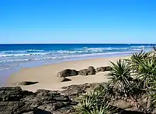
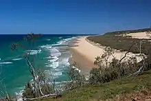
The landmark is the most easterly point on the island and a popular tourist destination.[3] Indian Head is located at one end of Seventy Five Mile Beach.
The outcrop consists of trachyte that was originally formed by volcanic activity 30 million years ago.[4]
History
The headland was named by Captain Cook when he passed it on the evening of 19 May 1770, noting "...on which a number of Natives were assembled...".[5] The term "Indian" was used at that time for the native people of many lands. The headland is known as Tukkee in the Badtjala language, meaning stone or stone knife.[1]
Attractions
Climbing Indian Head provides 360° views as well as good wildlife spotting opportunities, such as mantarays, sharks and whales. Camping around the headland is not permitted.[3]
References
- 1 2 "Indian Head – cape in the Fraser Coast Region (entry 47541)". Queensland Place Names. Queensland Government. Retrieved 18 October 2021.
- ↑ "Fraser Island – island in the Fraser Coast Region (entry 47533)". Queensland Place Names. Queensland Government. Retrieved 14 October 2021.
- 1 2 Hinchliffe, David; Julie Hinchliffe (2006). Explore Fraser Island. Robe, South Australia: Great Sandy Publications. pp. 84–85. ISBN 0-9758190-0-3.
- ↑ Cohen, B. E.; Vasconcelos, P. M.; Knesel, K. M. (February 2007). "40 Ar/ 39 Ar constraints on the timing of Oligocene intraplate volcanism in southeast Queensland ∗". Australian Journal of Earth Sciences. 54 (1): 105–125. doi:10.1080/08120090600981483. ISSN 0812-0099.
- ↑ Captain Cook's Journal During the First Voyage Round the World at Project Gutenberg
25°00′00″S 153°21′59″E / 25.00000°S 153.36639°E
