A Illa de Arousa
Isla de Arosa | |
|---|---|
| A Illa de Arousa | |
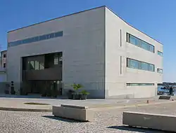
 Town Hall | |
 Flag  Coat of arms | |
 A Illa de Arousa Location in Spain | |
| Coordinates: 42°33′16″N 8°51′50″W / 42.55444°N 8.86389°W | |
| Country | |
| Autonomous community | |
| Province | Pontevedra |
| Comarca | Salnés |
| Government | |
| • Alcalde | Luis Arosa García (Socialists' Party of Galicia ; government alliance with Galician Nationalist Bloc) |
| Area | |
| • Total | 7 km2 (3 sq mi) |
| Elevation | 9 m (30 ft) |
| Population (2018)[1] | |
| • Total | 4,958 |
| • Density | 710/km2 (1,800/sq mi) |
| Demonym(s) | Arousán, á |
| Time zone | UTC+1 (CET) |
| • Summer (DST) | UTC+2 (CEST) |
| Postal code | 36626 |
| Website | http://www.ailladearousa.es/ |
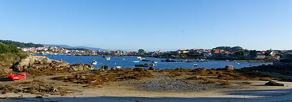
A Illa de Arousa (Spanish: La isla de Arosa) is the only island municipality in Galicia, Spain in the province of Pontevedra. It is located in the heart of the Ria de Arousa. According to 2021 INE the island's population was 4,951 inhabitants. The population is divided into several neighborhoods, and places of interest are the lighthouse's environment, the island of Areoso (close to the Illa de Arousa) and Carreirón Natural Park, which is listed as a special protection zone for heron birds populations among other birds that inhabit the island. The Holy viewpoint is the highest point on the island. "San Xulián da Illa de Arousa" is the only parish in this island. Some of its beaches are the following ones: A Area da Secada, A Lavanqueira, O Vao, Camaxe, Carreirón, Espiñeiro and O Cabodeiro.
A Illa de Arousa has five ports. Xufre is the most important and the other important docks include O Campo, Chazo and Cabodeiro.


Etymology
According to E. Bascuas, "Arousa", registered as insulam Arauza in 899, would belong to the old European hydronymy, and is derived from the Indoeuropean root *er- 'flow, move'.[2]
See also
References
- ↑ Municipal Register of Spain 2018. National Statistics Institute.
- ↑ Cf. pp. 540 y 541 de "La Hidronimia de Galicia: tres estratos ..". http://www.mondonedoferrol.org/estudios-mindonienses/MINDONIENSES%2024%20[protegido].pdf Archived 2016-06-11 at the Wayback Machine
External links
- Concello da Illa de Arousa Townhall of Arousa Island
- Arousa
- A Illa de Arousa - Paraíso Natural en Galicia