Jagüey Grande
Jagüey | |
|---|---|
.jpg.webp) Libertadores Square | |
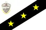
 Flag  Seal | |
.png.webp) Jagüey Grande municipality (red) within Matanzas Province (yellow) and Cuba | |
| Coordinates: 22°31′45″N 81°07′57″W / 22.52917°N 81.13250°W | |
| Country | Cuba |
| Province | Matanzas |
| Founded | 1762[1] |
| Area | |
| • Total | 882 km2 (341 sq mi) |
| Elevation | 135 m (443 ft) |
| Population (2007)[3] | |
| • Total | 87,771 |
| • Density | 65.5/km2 (170/sq mi) |
| Time zone | UTC-5 (EST) |
| Area code | +53-52 |
Jagüey Grande, simply known as Jagüey (Spanish pronunciation: [xaˈɣwej]), is a town and municipality in the Matanzas Province of Cuba. It is located east of the Zapata Peninsula, north of the Bahia de Cochinos, along the A1 motorway in the center of the province.
History
The town was founded in 1840 and was named after the tree Ficus citrifolia, locally named "Jagüey".
Geography
The municipality was historically divided into the barrios of Pueblo (town's centre), Gallardo, López, Murga Sinú and Rovira.[1] Nowadays it counts the town itself and the popular councils (consejos populares, i.e. villages) of Agramonte, Australia, San José de Marcos and Torriente. Agramonte, the most populated village, was an autonomous municipality until the 1976 reform.
Demographics
In 2007, the municipality of Jagüey Grande had a population of 87,771.[3] With a total area of 882 km2 (341 sq mi),[2] it has a population density of 65.5/km2 (170/sq mi).
Health
Notable people
- Mario García Menocal (1866–1941), politician, 3rd President
of Cuba
- Jaime Lucas Ortega y Alamino (1936-2019), archbishop
- Leopoldo Fernández (Tres Patines) (1904-1985), actor and comedian
See also
References
- 1 2 Guije.com. "Jagüey Grande" (in Spanish). Retrieved 2014-04-11.
- 1 2 Statoids (July 2003). "Municipios of Cuba". Retrieved 2007-12-16.
- 1 2 Atenas.cu (2004). "2004 Population trends, by Province and Municipality" (in Spanish). Archived from the original on 2007-09-27. Retrieved 2007-12-16.
External links
![]() Media related to Jagüey Grande at Wikimedia Commons
Media related to Jagüey Grande at Wikimedia Commons