40°37′56″N 079°06′20″W / 40.63222°N 79.10556°W
Indiana County–Jimmy Stewart Airport Indiana County Airport (Jimmy Stewart Field) | |||||||||||
|---|---|---|---|---|---|---|---|---|---|---|---|
 | |||||||||||
| Summary | |||||||||||
| Airport type | Public | ||||||||||
| Owner | Indiana County, Pennsylvania | ||||||||||
| Location | Indiana, Pennsylvania | ||||||||||
| Elevation AMSL | 1,405 ft / 428 m | ||||||||||
| Website | www.JimmyStewartAirport.com | ||||||||||
| Runways | |||||||||||
| |||||||||||
| Statistics (2007) | |||||||||||
| |||||||||||
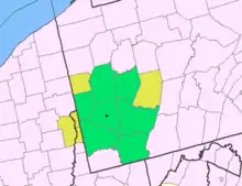
Indiana County–Jimmy Stewart Airport (IATA: IDI, ICAO: KIDI, FAA LID: IDI) (Indiana County Airport or Jimmy Stewart Field) is a county-owned public airport two miles (3 km) east of the borough of Indiana, in Indiana County, Pennsylvania.[1] The airport is about 65 miles (105 km) northeast of Pittsburgh and is in the Pittsburgh Combined Statistical Area. It is classified as a business service airport by the Pennsylvania Bureau of Aviation.
The airport was named after silver-screen legend Jimmy Stewart, who hails from Indiana, Pennsylvania.
Facilities
The airport covers 276 acres (112 ha) and has one asphalt runway, 11/29, 4,001 x 75 ft (1,220 x 23 m). The runway has medium intensity runway lighting (MIRL). The airport has three nonprecision approaches (LOC RWY 28, GPS 10, GPS 28).[1]
In the year ending March 31, 2007, the airport had 26,100 aircraft operations, average 71 per day: 95% general aviation, 3% military and 2% air taxi. 45 aircraft are based at the airport: 89% single-engine, 9% multi-engine and 2% ultralight.[1]
The Indiana County Airport Authority has received approval and funding for a new 5500 x 100 ft runway and will allow the installation of an instrument landing system (ILS). The old runway will become a parallel taxiway.
See also
References
- 1 2 3 4 FAA Airport Form 5010 for IDI PDF, effective 2007-10-25
- ↑ Indiana County Jimmy Stewart Airport, official web site
External links
- Indiana County–Jimmy Stewart Airport at the Pennsylvania Bureau of Aviation
- Resources for this airport:
- FAA airport information for IDI
- AirNav airport information for KIDI
- ASN accident history for IDI
- FlightAware airport information and live flight tracker
- NOAA/NWS weather observations: current, past three days
- SkyVector aeronautical chart, Terminal Procedures
