José Antonio Páez Municipality
Municipio José Antonio Páez | |
|---|---|
 Flag  Seal | |
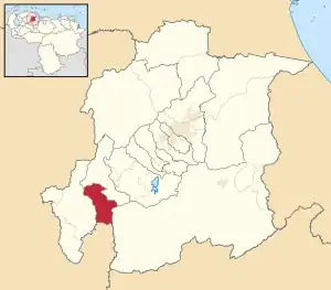 Location in Yaracuy | |
.svg.png.webp) José Antonio Páez Municipality Location in Venezuela | |
| Coordinates: 10°05′13″N 69°00′12″W / 10.0868401°N 69.0034107°W | |
| Country | |
| State | Yaracuy |
| Established | September 19, 1990 |
| Municipal seat | Sabana de Parra[*] |
| Area | |
| • Total | 109.0 km2 (42.1 sq mi) |
| Population (2001) | |
| • Total | 15,101 |
| • Density | 140/km2 (360/sq mi) |
| Time zone | UTC−4 (VET) |
| Website | Official website |
José Antonio Páez is one of the 14 municipalities of the state of Yaracuy, Venezuela. The municipality is located in southwestern Yaracuy, occupying an area of 135 km ² with a population of 15,101 inhabitants in 2001.[1] The capital lies at Sabana de Parra. It was named after José Antonio Páez.
References
External links
This article is issued from Wikipedia. The text is licensed under Creative Commons - Attribution - Sharealike. Additional terms may apply for the media files.