Kám | |
|---|---|
 Kám Location of Kám | |
| Coordinates: 47°06′09″N 16°52′32″E / 47.10256°N 16.87559°E | |
| Country | |
| County | Vas |
| Area | |
| • Total | 15.3 km2 (5.9 sq mi) |
| Population (2004) | |
| • Total | 465 |
| • Density | 30.39/km2 (78.7/sq mi) |
| Time zone | UTC+1 (CET) |
| • Summer (DST) | UTC+2 (CEST) |
| Postal code | 9841 |
| Area code | 94 |
Kám is a village in Vas county, Hungary.
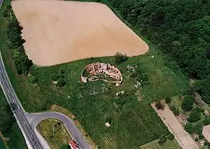
Kám, ruins from a bird's eye view
External links
- Street map (in Hungarian)
This article is issued from Wikipedia. The text is licensed under Creative Commons - Attribution - Sharealike. Additional terms may apply for the media files.