| Studená Vltava | |
|---|---|
 | |
| Native name | Kalte Moldau (German) |
| Location | |
| Countries | |
| State (DE) | Bavaria |
| Region (CZ) | South Bohemian |
| Physical characteristics | |
| Source | |
| • location | Haidmühle |
| Mouth | |
• location | Vltava river in Nová Pec |
• coordinates | 48°51′32″N 13°53′35″E / 48.8590°N 13.8931°E |
| Length | 24.7 km (15.3 mi) [1] |
| Basin features | |
| Progression | Vltava→ Elbe→ North Sea |
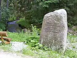
Studená Vltava (German: Kalte Moldau) is a river of Germany (Bavaria) and the Czech Republic (South Bohemian Region). It connects with the Teplá Vltava to form the Vltava. The confluence is located in Pěkná (an exclave of Nová Pec), near Volary.
See also
References
- ↑ Complete table of the Bavarian Waterbody Register by the Bavarian State Office for the Environment (xls, 10.3 MB)
This article is issued from Wikipedia. The text is licensed under Creative Commons - Attribution - Sharealike. Additional terms may apply for the media files.